METAR-TAF
Airports :
Auckland Airport
Auckland, New Zealand
latitude: 37-01S, longitude: 174-48E, elevation: 7 m
Current weather observation
The report was made 37 minutes ago, at 15:30 UTC
Wind 2 kt from the East/Southeast
Temperature 4°C
Humidity 100%
Pressure 1021 hPa
Visibility: 0700 m
light rain, fog
METAR: NZAA 271530Z AUTO 11002KT 0700 R23L/P2000N R05R/P2000N -RA FG NCD 04/04 Q1021
Time: 04:07 (16:07 UTC)
Forecast
The report was made 2 hours and 4 minutes ago, at 14:03 UTC
Forecast valid from 27 at 15 UTC to 28 at 18 UTC
Wind 5 kt from the South/Southeast
Visibility 10 km or more
Few clouds at a height of 2000 ft
Scattered clouds at a height of 4000 ft
Scattered clouds at a height of 4000 ft
From 28 at 0200 UTC
Wind 10 kt from the South/Southwest
Visibility 10 km or more
no clouds below 1500 m and no cumulonimbus
Becoming
from 28 at 04 UTC to 28 at 06 UTC
from 28 at 04 UTC to 28 at 06 UTC
Wind 2 kt from variable directions
TAF: NZAA 271403Z 2715/2818 15005KT 9999 FEW020 SCT040 FM280200 20010KT CAVOK BECMG 2804/2806 VRB02KT
Weather observations and forecasts of more than 4000 airports (METAR and TAF reports).
The available stations are represented by yellow and red dots on the map.
Hover mouse over dot to see the name of the station.
Then click to see weather observations and forecasts.
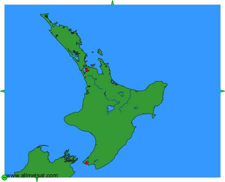
To change the map : click on the green buttons with a black cross to zoom in, on the green button with a dash to zoom out, or on the green arrows for adjacent maps.