METAR-TAF
Airports :
RNZAF Base Ohakea
Ohakea, New Zealand
latitude: 40-12S, longitude: 175-22E, elevation: 50 m
Current weather observation
The report was made 25 minutes ago, at 09:30 UTC
Wind 6 kt from the North
Temperature 6°C
Humidity 87%
Pressure 1025 hPa
Visibility 10 km or more
METAR: NZOH 210930Z AUTO 01006KT 9999 FEW250/// 06/04 Q1025
Time: 21:55 (09:55 UTC)
Forecast
The report was made 1 hour and 47 minutes ago, at 08:08 UTC
Forecast valid from 21 at 09 UTC to 22 at 12 UTC
Wind 5 kt from the North/Northeast
Visibility 10 km or more
Broken clouds at a height of 3500 ft
Temporary
from 21 at 15 UTC to 21 at 21 UTC
from 21 at 15 UTC to 21 at 21 UTC
Broken clouds at a height of 2000 ft
Becoming
from 21 at 23 UTC to 22 at 01 UTC
from 21 at 23 UTC to 22 at 01 UTC
Wind 10 kt from the West
Becoming
from 22 at 06 UTC to 22 at 08 UTC
from 22 at 06 UTC to 22 at 08 UTC
Wind 5 kt from the North/Northeast
TAF: NZOH 210808Z 2109/2212 02005KT 9999 BKN035 TEMPO 2115/2121 BKN020 BECMG 2123/2201 28010KT BECMG 2206/2208 03005KT
Weather observations and forecasts of more than 4000 airports (METAR and TAF reports).
The available stations are represented by yellow and red dots on the map.
Hover mouse over dot to see the name of the station.
Then click to see weather observations and forecasts.
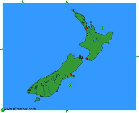
To change the map : click on the green buttons with a black cross to zoom in, on the green button with a dash to zoom out, or on the green arrows for adjacent maps.