METAR-TAF
Airports :
Wellington International Airport
Wellington, New Zealand
latitude: 41-20S, longitude: 174-48E, elevation: 12 m
Current weather observation
METAR: NZWN 060330Z AUTO 18027KT 6000 -RA BKN010/// OVC026/// 11/10 Q1006
Time: 16:07 (04:07 UTC)
Forecast
from 06 at 03 UTC to 06 at 05 UTC
from 06 at 05 UTC to 06 at 06 UTC
Broken clouds at a height of 2500 ft
from 06 at 05 UTC to 06 at 14 UTC
from 06 at 14 UTC to 06 at 16 UTC
from 06 at 14 UTC to 07 at 06 UTC
TAF: NZWN 060203Z 0603/0706 18030G40KT 6000 RA BKN008 TEMPO 0603/0605 3000 RADZ BECMG 0605/0606 16020G30KT 9999 -RA FEW015 BKN025 TEMPO 0605/0614 4000 RA BKN014 BECMG 0614/0616 6000 RA TEMPO 0614/0706 2000 +RA BKN012
Weather observations and forecasts of more than 4000 airports (METAR and TAF reports).
The available stations are represented by yellow and red dots on the map.
Hover mouse over dot to see the name of the station.
Then click to see weather observations and forecasts.
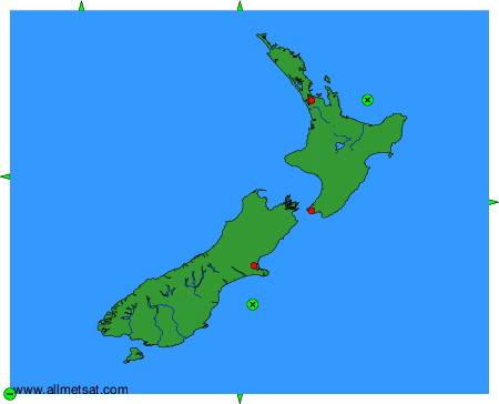
To change the map : click on the green buttons with a black cross to zoom in, on the green button with a dash to zoom out, or on the green arrows for adjacent maps.