METAR-TAF
Airports :
Toncontín International Airport
Tegucigalpa, Honduras
latitude: 14-03N, longitude: 087-13W, elevation: 994 m
Current weather observation
Broken clouds at a height of 3000 ft
METAR: MHTG 101300Z 32009KT 9999 FEW018 BKN030 21/18 Q1019 A3009 NOSIG
Time: 07:55 (13:55 UTC)
Forecast
from 10 at 16 UTC to 10 at 20 UTC
Few clouds at a height of 3400 ft, Cumulonimbus.
from 11 at 03 UTC to 11 at 04 UTC
Broken clouds at a height of 2800 ft
from 11 at 08 UTC to 11 at 12 UTC
TAF: MHTG 101100Z 1012/1112 VRB04KT 9999 SCT028 TX28/1020Z TN20/1112Z BECMG 1016/1020 05014KT SCT030TCU FEW034CB BECMG 1103/1104 VRB06KT FEW012 BKN028 TEMPO 1108/1112 6000 TSSHRA
Weather observations and forecasts of more than 4000 airports (METAR and TAF reports).
The available stations are represented by yellow and red dots on the map.
Hover mouse over dot to see the name of the station.
Then click to see weather observations and forecasts.
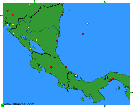
To change the map : click on the green buttons with a black cross to zoom in, on the green button with a dash to zoom out, or on the green arrows for adjacent maps.