METAR-TAF
Airports :
Enrique Malek International Airport
David, Panama
latitude: 08-24N, longitude: 082-25W, elevation: 29 m
Current weather observation
The report was made 4 hours and 41 minutes ago, at 03:00 UTC
Wind 4 kt from the North/Northwest
Temperature 30°C
Humidity 55%
Pressure 1006 hPa
Visibility 10 km or more
Few clouds at a height of 3000 ft
METAR: MPDA 290300Z 34004KT 9999 FEW030 30/20 Q1006 NOSIG
Time: 02:41 (07:41 UTC)
Forecast
The report was made 8 hours and 41 minutes ago, at 23:00 UTC
Forecast valid from 29 at 00 UTC to 29 at 12 UTC
Wind 7 kt from the Southwest
Visibility 10 km or more
Scattered clouds at a height of 1800 ft
Temporary
from 29 at 00 UTC to 29 at 02 UTC
from 29 at 00 UTC to 29 at 02 UTC
Wind 6 kt from the Northeast
Temporary
from 29 at 03 UTC to 29 at 07 UTC
from 29 at 03 UTC to 29 at 07 UTC
TAF: MPDA 282300Z 2900/2912 22007KT 9999 SCT018 TEMPO 2900/2902 04006KT TEMPO 2903/2907 CAVOK
Weather observations and forecasts of more than 4000 airports (METAR and TAF reports).
The available stations are represented by yellow and red dots on the map.
Hover mouse over dot to see the name of the station.
Then click to see weather observations and forecasts.
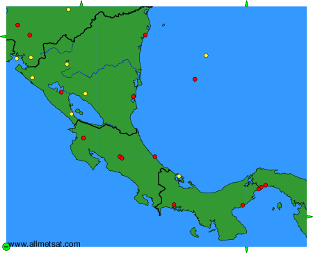
To change the map : click on the green buttons with a black cross to zoom in, on the green button with a dash to zoom out, or on the green arrows for adjacent maps.