METAR-TAF
Airports :
Aguenar – Hadj Bey Akhamok Airport
Tamanrasset, Algeria
latitude: 22-49N, longitude: 005-28E, elevation: 1377 m
Current weather observation
The report was made 12 minutes ago, at 10:30 UTC
Wind 5 kt from the South, varying between South/Southeast and West/Southwest
Temperature 21°C
Pressure 1018 hPa
Visibility 10 km or more
no clouds below 1500 m and no cumulonimbus
METAR: DAAT 181030Z 19005KT 150V250 CAVOK 21/// Q1018
Time: 11:42 (10:42 UTC)
Forecast
The report was made 5 hours and 42 minutes ago, at 05:00 UTC
Forecast valid from 18 at 06 UTC to 19 at 06 UTC
Wind 2 kt from variable directions
Visibility 10 km or more
no clouds below 1500 m and no cumulonimbus
Becoming
from 18 at 10 UTC to 18 at 12 UTC
from 18 at 10 UTC to 18 at 12 UTC
Wind 10 kt from the West
Becoming
from 18 at 19 UTC to 18 at 21 UTC
from 18 at 19 UTC to 18 at 21 UTC
Wind 2 kt from variable directions
TAF: DAAT 180500Z 1806/1906 VRB02KT CAVOK BECMG 1810/1812 26010KT BECMG 1819/1821 VRB02KT
Weather observations and forecasts of more than 4000 airports (METAR and TAF reports).
The available stations are represented by yellow and red dots on the map.
Hover mouse over dot to see the name of the station.
Then click to see weather observations and forecasts.
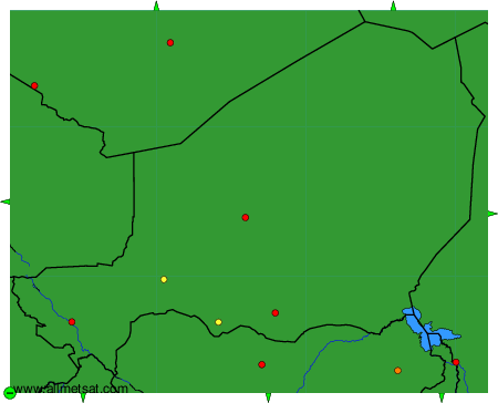
To change the map : click on the green buttons with a black cross to zoom in, on the green button with a dash to zoom out, or on the green arrows for adjacent maps.