METAR-TAF
Airports :
Zinder Airport
Zinder, Niger
latitude: 13-47N, longitude: 008-59E, elevation: 452 m
Current weather observation
The report was made 9 hours and 10 minutes ago, at 18:00 UTC
Wind 13 kt from the West/Southwest
Temperature 34°C
Humidity 53%
Pressure 1006 hPa
Visibility 10 km or more
no clouds below 1500 m and no cumulonimbus
METAR: DRZR 271800Z 25013KT CAVOK 34/23 Q1006
Time: 04:10 (03:10 UTC)
Forecast
The report was made 4 hours and 10 minutes ago, at 23:00 UTC
Forecast valid from 28 at 00 UTC to 28 at 24 UTC
Wind 8 kt from the West
Visibility 10 km or more
no clouds below 1500 m and no cumulonimbus
Temporary
from 28 at 02 UTC to 28 at 06 UTC
from 28 at 02 UTC to 28 at 06 UTC
Wind 25 kt from the East with gusts up to 45 kt
Visibility: 1000 m
Broken clouds at a height of 1400 ft
Scattered clouds at a height of 2500 ft, Cumulonimbus.
Scattered clouds at a height of 2500 ft, Cumulonimbus.
squalls, Blowing dust, thunderstorm, rain
TAF: DRZR 272300Z 2800/2824 26008KT CAVOK TEMPO 2802/2806 08025G45KT 1000 SQ BLDU TSRA BKN014 SCT025CB
Weather observations and forecasts of more than 4000 airports (METAR and TAF reports).
The available stations are represented by yellow and red dots on the map.
Hover mouse over dot to see the name of the station.
Then click to see weather observations and forecasts.
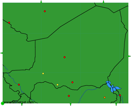
To change the map : click on the green buttons with a black cross to zoom in, on the green button with a dash to zoom out, or on the green arrows for adjacent maps.