METAR-TAF
Airports :
Nnamdi Azikiwe International Airport
Abuja, Nigeria
latitude: 9-00-24N, longitude: 7-15-47E, elevation: 342 m
Current weather observation
The report was made 31 minutes ago, at 09:00 UTC
Wind 10 kt from the North/Northwest
Temperature 31°C
Humidity 59%
Pressure 1013 hPa
Visibility 10 km or more
Broken clouds at a height of 1300 ft
METAR: DNAA 180900Z 33010KT 9999 BKN013 31/22 Q1013 NOSIG
Time: 10:31 (09:31 UTC)
Forecast
The report was made 4 hours and 31 minutes ago, at 05:00 UTC
Forecast valid from 18 at 06 UTC to 19 at 12 UTC
Wind 2 kt from variable directions
Visibility 10 km or more
no clouds below 1500 m and no cumulonimbus
Becoming
from 18 at 08 UTC to 18 at 10 UTC
from 18 at 08 UTC to 18 at 10 UTC
Wind 10 kt from the West/Southwest
Broken clouds at a height of 1200 ft
Probability 30% :
Temporary
from 18 at 16 UTC to 18 at 21 UTC
from 18 at 16 UTC to 18 at 21 UTC
Scattered clouds at a height of 1400 ft
Few clouds at a height of 2000 ft, Cumulonimbus.
Few clouds at a height of 2000 ft, Cumulonimbus.
thunderstorm
Becoming
from 18 at 21 UTC to 18 at 23 UTC
from 18 at 21 UTC to 18 at 23 UTC
Wind 2 kt from variable directions
TAF: DNAA 180500Z 1806/1912 VRB02KT CAVOK BECMG 1808/1810 24010KT BKN012 PROB30 TEMPO 1816/1821 TS SCT014 FEW020CB BECMG 1821/1823 VRB02KT CAVOK
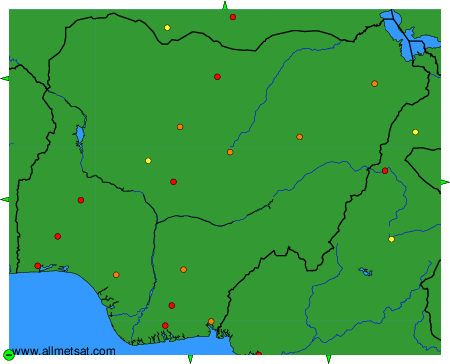
Weather observations and forecasts of more than 4000 airports (METAR and TAF reports).
The available stations are represented by yellow and red dots on the map.
Hover mouse over dot to see the name of the station.
Then click to see weather observations and forecasts.
To change the map : click on the green buttons with a black cross to zoom in, on the green button with a dash to zoom out, or on the green arrows for adjacent maps.