METAR-TAF
Airports :
Zinder Airport
Zinder, Niger
latitude: 13-47N, longitude: 008-59E, elevation: 452 m
Current weather observation
The report was made 5 hours and 10 minutes ago, at 18:00 UTC
Wind 7 kt from the West/Southwest
Temperature 34°C
Humidity 50%
Pressure 1009 hPa
Visibility: 8000 m
METAR: DRZR 261800Z 24007KT 8000 NSC 34/22 Q1009
Time: 00:10 (23:10 UTC)
Forecast
The report was made 6 hours and 10 minutes ago, at 17:00 UTC
Forecast valid from 26 at 18 UTC to 27 at 18 UTC
Wind 8 kt from the West
Visibility: 8000 m
Probability 40%
from 27 at 14 UTC to 27 at 18 UTC
from 27 at 14 UTC to 27 at 18 UTC
Wind 25 kt from the East with gusts up to 345 kt
Visibility: 0800 m
Broken clouds at a height of 1400 ft
Scattered clouds at a height of 2600 ft, Cumulonimbus.
Scattered clouds at a height of 2600 ft, Cumulonimbus.
squalls, Blowing dust, thunderstorm, rain
TAF: DRZR 261700Z 2618/2718 26008KT 8000 NSC PROB40 2714/2718 08025G345KT 0800 SQ BLDU TSRA BKN014 SCT026CB
Weather observations and forecasts of more than 4000 airports (METAR and TAF reports).
The available stations are represented by yellow and red dots on the map.
Hover mouse over dot to see the name of the station.
Then click to see weather observations and forecasts.
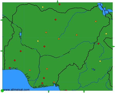
To change the map : click on the green buttons with a black cross to zoom in, on the green button with a dash to zoom out, or on the green arrows for adjacent maps.