METAR-TAF
Airports :
Ottawa
Abidjan
Accra
Algiers
Amsterdam
Atlanta
Bamako
Berlin
Bermuda
Bogotá
Boston
Brussels
Caracas
Cayenne
Conakry
Copenhagen
Curaçao
Dakar
Dublin
Fort-de-France
Funchal
Geneva
Gibraltar
Gran Canaria
Halifax
Havana
Iqaluit
Kangerlussuaq
Kingston
Lagos
Libreville
Lisbon
London-Heathrow
Luxembourg
Madrid
Malabo
Miami
Montreal Trudeau
Nassau
New York / LaGuardia
Niamey
Nouakchott
Oslo
Ottawa
Ouagadougou
Palma de Mallorca
Paris-Charles De Gaulle
Pittsburgh
Pointe-à-Pitre
Ponta Delgada
Port of Spain
Prague
Quebec City
Rabat
Reykjavík
Rome-Fiumicino
San Juan
Sint Maarten
St. John's
Thule
Toronto
Tripoli
Tunis
Washington
Yaoundé
North Atlantic
Africa
Algeria
Algeria, North
Arctic Ocean
Austria
Azores
Belgium
Benin
Bermuda
Burkina Faso
Cameroon
Canary Islands
Cape Verde
Colombia
Costa Rica
Cuba
Czech Republic
Delaware
Denmark
Dominican Republic
England
Europe
Faroe Islands
Florida
France
Gambia
Georgia
Germany
Ghana
Greenland
Guinea
Guinea-Bissau
Guyana, Suriname, French Guiana
Haiti
Iceland
Indiana
Ireland
Italy
Italy, North
Ivory coast
Jamaica
Lesser Antilles
Liberia
Luxembourg
Madeira
Mali
Maritimes
Maryland
Mauritania
Morocco
Netherlands
New England
New York
Nicaragua
Niger
Nigeria
North America
North Carolina
North Sea
Nunavut, Baffin Island, Ellesmere
Ohio
Ontario, South
Panama
Pennsylvania
Portugal
Puerto Rico
Quebec
Quebec, South
Scandinavia, Southwest
Scotland
Senegal
Shetland
Sierra Leone
Slovenia
South America
South Atlantic
South Carolina
South Pacific
Spain
Switzerland
The Bahamas
Togo
Trinidad and Tobago
Tunisia
United Kingdom
Venezuela
Virginia
Wales
Ottawa Macdonald–Cartier International Airport Ottawa, Ontario, Canada
latitude: 45-19N, longitude: 075-40W, elevation: 116 m
Current weather observation The report was made 39 minutes ago, at 04:00 UTC
Wind 12 kt from the Southwest with gusts up to 19 kt
Temperature 0 °C
Humidity 100 %
Pressure 987 hPa
Visibility: 2.4 km
Overcast at a height of 400 ft
light snow
METAR: CYOW 170400Z 23012G19KT 1 1/2SM -SN OVC004 00/M00 A2916 RMK SN5SC3 PRESFR SLP879
Time: 00:39 (04:39 UTC) Forecast The report was made 1 hour and 59 minutes ago, at 02:40 UTC
Forecast valid from 17 at 03 UTC to 18 at 06 UTC
Wind 15 kt from the Southwest with gusts up to 25 kt
Visibility: 9.7 km
Scattered clouds at a height of 800 ft Overcast at a height of 4000 ft
light rain, mist
Becoming
Visibility: 1.2 km
at a height of 700 ft
light snow
From 17 at 0500 UTC
Wind 18 kt from the Southwest with gusts up to 30 kt
Visibility: 0.8 km
at a height of 600 ft
snow
Temporary
Visibility: 2.4 km
at a height of 1200 ft
light snow
From 17 at 0700 UTC
Wind 18 kt from the Southwest with gusts up to 28 kt
Visibility: 1.6 km
Overcast at a height of 1200 ft
light snow
From 17 at 0900 UTC
Wind 18 kt from the Southwest with gusts up to 30 kt
Visibility: 10 km
Broken clouds at a height of 3000 ft
light snow showers
Probability 30%
Visibility: 1.6 km
Overcast at a height of 2000 ft
light snow showers, Blowing snow
From 17 at 1200 UTC
Wind 20 kt from the West/Southwest with gusts up to 30 kt
Visibility: 10 km
Broken clouds at a height of 3000 ft
light snow showers
Becoming
Wind 15 kt from the West with gusts up to 25 kt
From 17 at 2100 UTC
Wind 15 kt from the West/Northwest with gusts up to 25 kt
Visibility: 10 km
Broken clouds at a height of 4000 ft
Becoming
Wind 12 kt from the West
From 18 at 0500 UTC
Wind 8 kt from the West/Northwest
Visibility: 10 km
Few clouds at a height of 4000 ft
TAF: CYOW 170240Z 1703/1806 22015G25KT 6SM -RA BR SCT008 OVC040 BECMG 1703/1705 3/4SM -SN VV007 FM170500 23018G30KT 1/2SM SN VV006 TEMPO 1705/1707 1 1/2SM -SN VV012 FM170700 23018G28KT 2SM -SN OVC012 FM170900 23018G30KT P6SM -SHSN BKN030 PROB30 1709/1712 2SM -SHSN BLSN OVC020 FM171200 24020G30KT P6SM -SHSN BKN030 BECMG 1716/1718 27015G25KT FM172100 29015G25KT P6SM BKN040 BECMG 1722/1724 28012KT FM180500 29008KT P6SM FEW040 RMK NXT FCST BY 170600Z
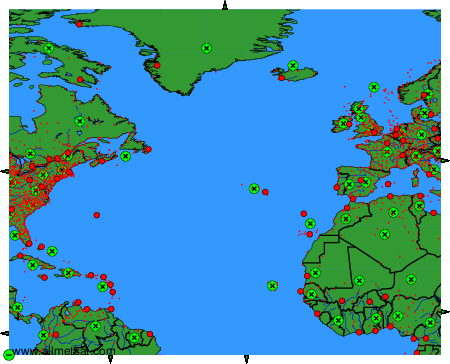
Weather observations and forecasts of more than 4000 airports (METAR and TAF reports).
The available stations are represented by yellow and red dots on the map.
Hover mouse over dot to see the name of the station.
Then click to see weather observations and forecasts.
To change the map : click on the green buttons with a black cross to zoom in, on the green button with a dash to zoom out, or on the green arrows for adjacent maps.