METAR-TAF
Airports :
Berlin Brandenburg Airport
Berlin, Germany
latitude: 52-23N, longitude: 013-31E, elevation: 47 m
Current weather observation
The report was made 33 minutes ago, at 02:50 UTC
Wind 11 kt from the West
Temperature 15°C
Humidity 72%
Pressure 1020 hPa
Visibility 10 km or more
Few clouds at a height of 2400 ft
METAR: EDDB 030250Z AUTO 28011KT 9999 FEW024 15/10 Q1020 TEMPO 30015G25KT
Time: 05:23 (03:23 UTC)
Forecast
The report was made 4 hours and 23 minutes ago, at 23:00 UTC
Forecast valid from 03 at 00 UTC to 03 at 24 UTC
Wind 12 kt from the West
Visibility 10 km or more
Scattered clouds at a height of 4000 ft
Becoming
from 03 at 06 UTC to 03 at 09 UTC
from 03 at 06 UTC to 03 at 09 UTC
Wind 15 kt from the West with gusts up to 25 kt
Temporary
from 03 at 08 UTC to 03 at 18 UTC
from 03 at 08 UTC to 03 at 18 UTC
Wind 20 kt from the West with gusts up to 35 kt
Probability 30% :
Temporary
from 03 at 11 UTC to 03 at 17 UTC
from 03 at 11 UTC to 03 at 17 UTC
Wind 25 kt from the West/Northwest with gusts up to 40 kt
TAF: EDDB 022300Z 0300/0324 28012KT 9999 SCT040 BECMG 0306/0309 28015G25KT TEMPO 0308/0318 28020G35KT PROB30 TEMPO 0311/0317 29025G40KT
Weather observations and forecasts of more than 4000 airports (METAR and TAF reports).
The available stations are represented by yellow and red dots on the map.
Hover mouse over dot to see the name of the station.
Then click to see weather observations and forecasts.
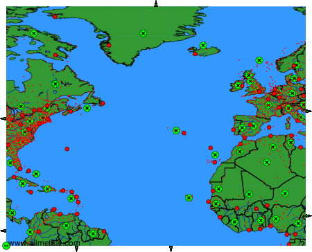
To change the map : click on the green buttons with a black cross to zoom in, on the green button with a dash to zoom out, or on the green arrows for adjacent maps.