METAR-TAF
Airports :
Sumburgh Airport
Sumburgh, Shetland, Scotland
latitude: 59-53N, longitude: 001-18W, elevation: 5 m
Current weather observation
The report was made 41 minutes ago, at 17:20 UTC
Wind 10 kt from the West
Temperature 12°C
Humidity 88%
Pressure 1011 hPa
Visibility 10 km or more
METAR: EGPB 011720Z AUTO 26010KT 9999 FEW006/// SCT028/// BKN041/// 12/10 Q1011 RERA
Time: 19:01 (18:01 UTC)
Forecast
The report was made 1 hour and 9 minutes ago, at 16:52 UTC
Forecast valid from 01 at 18 UTC to 02 at 03 UTC
Wind 15 kt from the West
Visibility 10 km or more
Few clouds at a height of 1400 ft
Scattered clouds at a height of 2500 ft
Scattered clouds at a height of 2500 ft
Temporary
from 01 at 18 UTC to 02 at 03 UTC
from 01 at 18 UTC to 02 at 03 UTC
Visibility: 8000 m
light rain showers
Probability 30% :
Temporary
from 01 at 18 UTC to 02 at 03 UTC
from 01 at 18 UTC to 02 at 03 UTC
Visibility: 6000 m
Broken clouds at a height of 1400 ft
rain showers
TAF: EGPB 011652Z 0118/0203 27015KT 9999 FEW014 SCT025 TEMPO 0118/0203 8000 -SHRA PROB30 TEMPO 0118/0203 6000 SHRA BKN014
Weather observations and forecasts of more than 4000 airports (METAR and TAF reports).
The available stations are represented by yellow and red dots on the map.
Hover mouse over dot to see the name of the station.
Then click to see weather observations and forecasts.
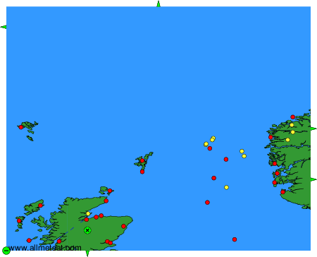
To change the map : click on the green buttons with a black cross to zoom in, on the green button with a dash to zoom out, or on the green arrows for adjacent maps.