METAR-TAF
Airports :
Thule
Akulivik
Alert
Arctic Bay
Arviat
Aupaluk
Brevoort Island
Cape Dorset
Cape Dyer
Cape Hooper
Cape Kakkiviak
Cape Kiglapait
Cape Mercy
Chesterfield Inlet
Churchill
Clyde
Coral Harbour
Dewar Lakes
Eureka
Fort Severn
Grise Fiord
Hall Beach
Igloolik
Inukjuak
Iqaluit
Ivujivik
Kangiqsualujjuaq
Kangiqsujuaq
Kangirsuk
Kimmirut
Kugaaruk
Kugaaruk
Kuujjuaq
Longstaff Bluff
Nain
Pangnirtung
Pond Inlet
Puvirnituq
Qikiqtarjuaq
Qikiqtarjuaq
Quaqtaq
Rankin Inlet
Repulse Bay
Resolution Island
Saglek Bay
Salluit
Sanikiluaq
Shepherd Bay
Taloyoak
Tasiujaq
Thule
Umiujaq
Whale Cove
Nunavut, Baffin Island, Ellesmere
Arctic Ocean
Greenland
Manitoba
North America
Nunavut
Ontario, North
Quebec
Thule Air Base Thule, Greenland
latitude: 76-32N, longitude: 068-42W, elevation: 77 m
Current weather observation The report was made 16 minutes ago, at 07:55 UTC
Wind 5 kt from the Southeast
Temperature 11 °C
Humidity 71 %
Pressure 1019 hPa
Visibility 10 km or more
Overcast at a height of 5000 ft
METAR: BGTL 310755Z AUTO 13005KT 9999 OVC050 11/06 A3009 RMK AO2 RAB30E41 SLP170 P0001 T01060062 TSNO $
Time: 05:11 (08:11 UTC) Forecast The report was made 14 hours and 11 minutes ago, at 18:00 UTC
Forecast valid from 30 at 18 UTC to 31 at 24 UTC
Wind 12 kt from the Southeast
Visibility 10 km or more
Broken clouds at a height of 6500 ft
Becoming
Wind 15 kt from the Southeast with gusts up to 25 kt
Visibility 10 km or more
Scattered clouds at a height of 10000 ft
Becoming
Wind 12 kt from the East
Visibility: 9000 m
Broken clouds at a height of 8000 ft
light rain showers
Becoming
Wind 12 kt from the East
Visibility 10 km or more
Overcast at a height of 8000 ft
TAF: BGTL 301800Z 3018/3124 13012KT 9999 BKN065 QNH3007INS BECMG 3020/3021 13015G25KT 9999 SCT100 510003 QNH3008INS BECMG 3105/3106 100012KT 9000 -SHRA BKN080 510003 QNH3007INS BECMG 3115/3116 10012KT 9999 NSW OVC080 QNH3006INS TX15/3018Z TN11/3105Z
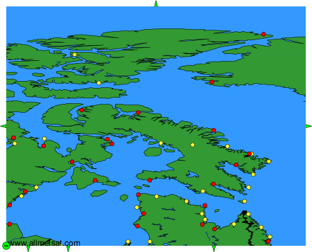
Weather observations and forecasts of more than 4000 airports (METAR and TAF reports).
The available stations are represented by yellow and red dots on the map.
Hover mouse over dot to see the name of the station.
Then click to see weather observations and forecasts.
To change the map : click on the green buttons with a black cross to zoom in, on the green button with a dash to zoom out, or on the green arrows for adjacent maps.