METAR-TAF
Airports :
Rankin Inlet Airport
Rankin Inlet, Nunavut, Canada
latitude: 62-49N, longitude: 092-07W, elevation: 31 m
Current weather observation
The report was made 46 minutes ago, at 08:00 UTC
Wind 9 kt from the Northwest
Temperature 10°C
Humidity 93%
Pressure 1013 hPa
Visibility: 24.1 km
Few clouds at a height of 25000 ft
METAR: CYRT 010800Z 32009KT 15SM FEW250 10/09 A2991 RMK CI2 SLP131
Time: 03:46 (08:46 UTC)
Forecast
The report was made 3 hours and 6 minutes ago, at 05:40 UTC
Forecast valid from 01 at 06 UTC to 01 at 18 UTC
Wind 10 kt from the Northwest
Visibility: 10 km
Few clouds at a height of 5000 ft
From 01 at 1100 UTC
Wind 8 kt from the West/Northwest
Visibility: 10 km
Scattered clouds at a height of 4000 ft
Temporary
from 01 at 11 UTC to 01 at 18 UTC
from 01 at 11 UTC to 01 at 18 UTC
Broken clouds at a height of 4000 ft
Becoming
from 01 at 13 UTC to 01 at 15 UTC
from 01 at 13 UTC to 01 at 15 UTC
Wind 12 kt from the South/Southwest
TAF: CYRT 010540Z 0106/0118 32010KT P6SM FEW050 FM011100 30008KT P6SM SCT040 TEMPO 0111/0118 BKN040 BECMG 0113/0115 20012KT RMK NXT FCST BY 011200Z
Weather observations and forecasts of more than 4000 airports (METAR and TAF reports).
The available stations are represented by yellow and red dots on the map.
Hover mouse over dot to see the name of the station.
Then click to see weather observations and forecasts.
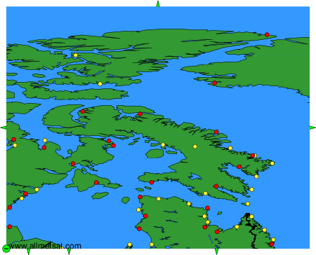
To change the map : click on the green buttons with a black cross to zoom in, on the green button with a dash to zoom out, or on the green arrows for adjacent maps.