The report was made 4 hours and 28 minutes ago, at 12:40 UTC
Forecast valid from 27 at 13 UTC to 28 at 01 UTC
Wind 10 kt from the Southeast
Visibility: 6.4 km
Broken clouds at a height of 500 ft
mist
Temporary from 27 at 13 UTC to 27 at 15 UTC
Visibility: 0.4 km
at a height of 200 ft
fog
From 27 at 1500 UTC
Wind 12 kt from the Southeast
Visibility: 10 km
Scattered clouds at a height of 400 ft Broken clouds at a height of 4000 ft
Temporary from 27 at 15 UTC to 27 at 18 UTC
Visibility: 3.2 km
Overcast at a height of 400 ft
light rain, mist
Probability 30% from 27 at 15 UTC to 27 at 18 UTC
Visibility: 0.8 km
at a height of 300 ft
fog
From 27 at 1800 UTC
Wind 8 kt from the Southeast
Visibility: 10 km
Broken clouds at a height of 3000 ft
Temporary from 27 at 18 UTC to 28 at 01 UTC
Broken clouds at a height of 2000 ft
TAF: CYUX 271240Z 2713/2801 14010KT 4SM BR BKN005 TEMPO 2713/2715 1/4SM FG VV002 FM271500 14012KT P6SM SCT004 BKN040 TEMPO 2715/2718 2SM -RA BR OVC004 PROB30 2715/2718 1/2SM FG VV003 FM271800 14008KT P6SM BKN030 TEMPO 2718/2801 BKN020 RMK FCST BASED ON AUTO OBS. NXT FCST BY 271900Z
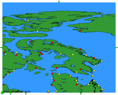
Weather observations and forecasts of more than 4000 airports (METAR and TAF reports).
The available stations are represented by yellow and red dots on the map.
Hover mouse over dot to see the name of the station.
Then click to see weather observations and forecasts.
To change the map : click on the green buttons with a black cross to zoom in, on the green button with a dash to zoom out, or on the green arrows for adjacent maps.