METAR-TAF
Airports :
Churchill
Arctic Bay
Arviat
Baker Lake
Cambridge Bay
Cape Peel West
Chesterfield Inlet
Churchill
Coral Harbour
Ekati
Ennadai Lake
Eureka
Fort Chipewyan
Fort McMurray
Fort Resolution
Fort Severn
Fort Smith
Gamèti
Gillam
Gillam
Gjoa Haven
Grise Fiord
Hall Beach
Hat Island
Hay River
High Level
Igloolik
Key Lake
Kugaaruk
Kugaaruk
Kugluktuk
Lower Carp Lake
Lupin Mine
Lutselk'e
Lynn Lake
Peace River
Rankin Inlet
Repulse Bay
Resolute
Shepherd Bay
Southend
Stony Rapids
Tadoule Lake
Taloyoak
Uranium City
Waterton Park Gate
Wekweeti
Whale Cove
Whatì
Yellowknife
Nunavut
Alberta
Arctic Ocean
British Columbia
Manitoba
North America
Northwest Territories
Nunavut, Baffin Island, Ellesmere
Ontario, North
Quebec
Saskatchewan
Yukon
Churchill Airport Churchill, Manitoba, Canada
latitude: 58-44N, longitude: 094-04W, elevation: 92 ft
Current weather observation The report was made 47 minutes ago, at 07:00 UTC
Wind 17 mph from the Northwest with gusts up to 24 mph
Temperature 54 °F
Humidity 76 %
Pressure 29.87 in. Hg
Visibility: 15 miles
Broken clouds at a height of 4400 ft Broken clouds at a height of 25000 ft
METAR: CYYQ 080700Z 32015G21KT 15SM BKN044 BKN250 12/08 A2987 RMK SC7CI1 CI TR SLP117
Time: 02:47 (07:47 UTC) Forecast The report was made 2 hours and 7 minutes ago, at 05:40 UTC
Forecast valid from 08 at 06 UTC to 09 at 06 UTC
Wind 14 mph from the Northwest with gusts up to 25 mph
Visibility: 6 miles
Broken clouds at a height of 4000 ft
Temporary
Visibility: 6 miles
Overcast at a height of 2000 ft
light rain showers
Becoming
Wind 12 mph from the North
From 09 at 0000 UTC
Wind 6 mph from the North
Visibility: 6 miles
Scattered clouds at a height of 6000 ft Broken clouds at a height of 17000 ft
Becoming
Wind 7 mph from the West
TAF: CYYQ 080540Z 0806/0906 31012G22KT P6SM BKN040 TEMPO 0806/0824 P6SM -SHRA OVC020 BECMG 0816/0818 01010KT FM090000 35005KT P6SM SCT060 BKN170 BECMG 0902/0904 26006KT RMK NXT FCST BY 081200Z
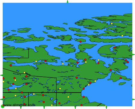
Weather observations and forecasts of more than 4000 airports (METAR and TAF reports).
The available stations are represented by yellow and red dots on the map.
Hover mouse over dot to see the name of the station.
Then click to see weather observations and forecasts.
To change the map : click on the green buttons with a black cross to zoom in, on the green button with a dash to zoom out, or on the green arrows for adjacent maps.