METAR-TAF
Airports :
Kish International Airport
Kish, Iran
latitude: 26-31-36N, longitude: 053-58-54E, elevation: 30 m
Current weather observation
The report was made 23 minutes ago, at 08:00 UTC
Wind 8 kt from the West/Southwest
Temperature 36°C
Humidity 53%
Pressure 1000 hPa
Visibility: 6000 m
Few clouds at a height of 3000 ft
METAR: OIBK 110800Z 24008KT 6000 FEW030 36/25 Q1000
Time: 12:53 (08:23 UTC)
Forecast
The report was made 2 hours and 53 minutes ago, at 05:30 UTC
Forecast valid from 11 at 06 UTC to 12 at 12 UTC
Wind 8 kt from the West/Southwest
Visibility: 7000 m
Temporary
from 11 at 09 UTC to 11 at 17 UTC
from 11 at 09 UTC to 11 at 17 UTC
Wind 16 kt from the West
Becoming
from 11 at 17 UTC to 11 at 19 UTC
from 11 at 17 UTC to 11 at 19 UTC
Visibility: 4000 m
haze
Temporary
from 11 at 21 UTC to 12 at 04 UTC
from 11 at 21 UTC to 12 at 04 UTC
Visibility: 2000 m
Becoming
from 12 at 06 UTC to 12 at 08 UTC
from 12 at 06 UTC to 12 at 08 UTC
Visibility: 7000 m
TAF: OIBK 110530Z 1106/1212 24008KT 7000 NSC TEMPO 1109/1117 27016KT BECMG 1117/1119 4000 HZ TEMPO 1121/1204 2000 BR/HZ BECMG 1206/1208 7000
Weather observations and forecasts of more than 4000 airports (METAR and TAF reports).
The available stations are represented by yellow and red dots on the map.
Hover mouse over dot to see the name of the station.
Then click to see weather observations and forecasts.
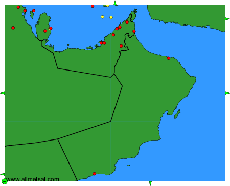
To change the map : click on the green buttons with a black cross to zoom in, on the green button with a dash to zoom out, or on the green arrows for adjacent maps.