METAR-TAF
Airports :
Al Maktoum International Airport
Dubai, United Arab Emirates
latitude: 24-53-49N, longitude: 55-09-40E, elevation: 35 m
Current weather observation
The report was made 20 minutes ago, at 05:30 UTC
Wind 2 kt from variable directions
Temperature 37°C
Humidity 54%
Pressure 999 hPa
Visibility: 7000 m
METAR: OMDW 280530Z VRB02KT 7000 NSC 37/26 Q0999 NOSIG
Time: 09:50 (05:50 UTC)
Forecast
The report was made 50 minutes ago, at 05:00 UTC
Forecast valid from 28 at 06 UTC to 29 at 12 UTC
Wind 5 kt from the Southeast
Visibility: 7000 m
Becoming
from 28 at 08 UTC to 28 at 10 UTC
from 28 at 08 UTC to 28 at 10 UTC
Wind 15 kt from the North/Northwest
Probability 30% :
Temporary
from 28 at 08 UTC to 28 at 14 UTC
from 28 at 08 UTC to 28 at 14 UTC
Wind 20 kt from variable directions with gusts up to 30 kt
Visibility: 3000 m
Few clouds at a height of 4000 ft, Towering cumulus.
Blowing dust
Becoming
from 28 at 16 UTC to 28 at 18 UTC
from 28 at 16 UTC to 28 at 18 UTC
Wind 5 kt from the North/Northeast
Becoming
from 29 at 08 UTC to 29 at 10 UTC
from 29 at 08 UTC to 29 at 10 UTC
Wind 15 kt from the North/Northwest
TAF: OMDW 280500Z 2806/2912 14005KT 7000 NSC BECMG 2808/2810 33015KT PROB30 TEMPO 2808/2814 VRB20G30KT 3000 BLDU FEW040TCU BECMG 2816/2818 03005KT BECMG 2908/2910 34015KT
Weather observations and forecasts of more than 4000 airports (METAR and TAF reports).
The available stations are represented by yellow and red dots on the map.
Hover mouse over dot to see the name of the station.
Then click to see weather observations and forecasts.
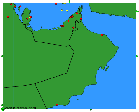
To change the map : click on the green buttons with a black cross to zoom in, on the green button with a dash to zoom out, or on the green arrows for adjacent maps.