METAR-TAF
Airports :
Pullman / Moscow
Alturas
Astoria
Aurora
Baker City
Bend
Burns
Caldwell
Chehalis
Corvallis
Crescent City
Ellensburg
Ephrata
Eugene
Hermiston
Hillsboro
Hoquiam
Kelso
Klamath Falls
La Grande
Lakeview
Lewiston
McMinnville
Meacham
Medford
Montague
Moses Lake
Mount Shasta
Newport
North Bend
Olympia
Ontario
Pasco
Pendleton
Portland
Pullman / Moscow
Redmond
Richland
Rome
Roseburg
Salem
Scappoose
Seneca
Sexton Summit
Shelton
Stampede Pass
Tacoma
Tacoma
Tacoma / Fort Lewis
The Dalles
Tillamook
Troutdale
Vancouver
Walla Walla
Wenatchee
Yakima
Oregon
California, North
Idaho
Montana, West
Nevada
North America
Washington
Pullman–Moscow Regional Airport Pullman / Moscow, Washington, United States
latitude: 46-44-38N, longitude: 117-06-35W, elevation: 2555 ft
Current weather observation The report was made 43 minutes ago, at 13:53 UTC
Wind 13 mph from the East
Temperature 57 °F
Humidity 67 %
Pressure 30.04 in. Hg
Visibility: 10 miles
Clear sky
METAR: KPUW 211353Z AUTO 10011KT 10SM R05/5000VP6000FT CLR 14/08 A3004 RMK AO2 SLP162 T01440083
Time: 07:36 (14:36 UTC) Forecast The report was made 3 hours and 16 minutes ago, at 11:20 UTC
Forecast valid from 21 at 12 UTC to 22 at 12 UTC
Wind 12 mph from the East
Visibility: 6 miles
Clear sky
From 21 at 1500 UTC
Wind 15 mph from the East
Visibility: 6 miles
Clear sky
From 21 at 1900 UTC
Wind 8 mph from the South/Southeast
Visibility: 6 miles
Few clouds at a height of 8000 ft
From 21 at 2200 UTC
Wind 6 mph from the West
Visibility: 6 miles
Few clouds at a height of 9000 ft Few clouds at a height of 25000 ft
From 22 at 0600 UTC
Wind 2 mph from variable directions
Visibility: 6 miles
Scattered clouds at a height of 9000 ft Broken clouds at a height of 20000 ft
TAF: KPUW 211120Z 2112/2212 10010KT P6SM SKC FM211500 10013KT P6SM SKC FM211900 15007KT P6SM FEW080 FM212200 27005KT P6SM FEW090 FEW250 FM220600 VRB02KT P6SM SCT090 BKN200
Weather observations and forecasts of more than 4000 airports (METAR and TAF reports).
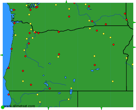
The available stations are represented by yellow and red dots on the map.
Hover mouse over dot to see the name of the station.
Then click to see weather observations and forecasts.
To change the map : click on the green buttons with a black cross to zoom in, on the green button with a dash to zoom out, or on the green arrows for adjacent maps.