METAR: CYQA 010000Z AUTO 26002KT 9SM CLR 26/20 A2991 RMK SLP129 DENSITY ALT 2500FT
Time: 20:25 (00:25 UTC)
Forecast
The report was made 4 hours and 45 minutes ago, at 19:40 UTC
Forecast valid from 31 at 20 UTC to 01 at 02 UTC
Wind 7 mph from the West
Visibility: 6 miles
Few clouds at a height of 6000 ft
TAF: CYQA 311940Z 3120/0102 27006KT P6SM FEW060 RMK FCST BASED ON AUTO OBS. NXT FCST BY 011200Z
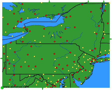
Weather observations and forecasts of more than 4000 airports (METAR and TAF reports).
The available stations are represented by yellow and red dots on the map.
Hover mouse over dot to see the name of the station.
Then click to see weather observations and forecasts.
To change the map : click on the green buttons with a black cross to zoom in, on the green button with a dash to zoom out, or on the green arrows for adjacent maps.