METAR: CYSN 021700Z 34009G25KT 300V050 4SM -SHRA SCT005 OVC033TCU 20/20 A2973 RMK SF3TCU5 SLP068 DENSITY ALT 1300FT
Time: 13:13 (17:13 UTC)
Forecast
The report was made 4 hours and 17 minutes ago, at 12:56 UTC
Forecast valid from 02 at 13 UTC to 03 at 01 UTC
Wind 9 mph from the Northeast
Visibility: 6 miles
Scattered clouds at a height of 800 ft Overcast at a height of 2500 ft
light rain
Temporary from 02 at 13 UTC to 02 at 20 UTC
Visibility: 3 miles
Overcast at a height of 800 ft
rain, mist
Probability 30% from 02 at 13 UTC to 02 at 15 UTC
Wind 17 mph from variable directions with gusts up to 29 mph
Visibility: 1 miles
Broken clouds at a height of 600 ft Overcast at a height of 1200 ft, Cumulonimbus.
thunderstorm, heavy rain, mist
From 02 at 2000 UTC
Wind 12 mph from the Southwest
Visibility: 6 miles
Scattered clouds at a height of 800 ft Overcast at a height of 2500 ft
light rain, mist
Temporary from 02 at 20 UTC to 03 at 01 UTC
Visibility: 3 miles
Overcast at a height of 800 ft
rain, mist
Probability 30% from 02 at 20 UTC to 02 at 24 UTC
Wind 17 mph from variable directions with gusts up to 29 mph
Visibility: 1 miles
Broken clouds at a height of 600 ft Overcast at a height of 1200 ft, Cumulonimbus.
thunderstorm, heavy rain, mist
TAF: CYSN 021256Z 0213/0301 05008KT P6SM -RA SCT008 OVC025 TEMPO 0213/0220 3SM RA BR OVC008 PROB30 0213/0215 VRB15G25KT 1SM +TSRA BR BKN006 OVC012CB FM022000 22010KT 6SM -RA BR SCT008 OVC025 TEMPO 0220/0301 3SM RA BR OVC008 PROB30 0220/0224 VRB15G25KT 1SM +TSRA BR BKN006 OVC012CB RMK NXT FCST BY 022000Z
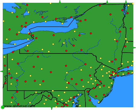
Weather observations and forecasts of more than 4000 airports (METAR and TAF reports).
The available stations are represented by yellow and red dots on the map.
Hover mouse over dot to see the name of the station.
Then click to see weather observations and forecasts.
To change the map : click on the green buttons with a black cross to zoom in, on the green button with a dash to zoom out, or on the green arrows for adjacent maps.