METAR-TAF
Airports :
Millville
Aberdeen
Albany
Allentown
Altoona
Andover
Annapolis
Ashtabula
Atlantic City
Baltimore
Baltimore
Baltimore Inner Harbor
Bancroft
Beaver Falls
Bedford
Belmar / Farmingdale
Bennington
Binghamton
Borden
Bradford
Bridgeport
Buckhannon
Buffalo
Burlington
Burlington
Butler
Caldwell
Camp Springs
Clarksburg
Clearfield
Coatesville
Cobourg
College Park
Collingwood
Cumberland
Danbury
Dansville
Dover
Doylestown
DuBois / Falls Creek
Dunkirk
Easton
Elkins
Elmira / Corning
Erie
Farmingdale
Fort Belvoir
Fort Drum
Fort George G. Meade
Fort Indiantown Gap
Franklin
Franklin County
Frederick
Frelighsburg
Front Royal
Fulton
Gaithersburg
Glens Falls
Hagerstown
Hamilton
Harrisburg
Harrisburg / Middletown
Hazleton
Indiana
Islip
Ithaca
Jamestown
Johnstown
Kingston
Lagoon City
Lancaster
Latrobe
Leesburg
Linden
Long Point
Manassas
Martinsburg
Massena
Meadville
Meriden
Millville
Montgomery
Monticello
Morgantown
Morristown
Mount Forest
Mount Holly
Mount Pocono
Muskoka
Newark
Newburgh
New Castle
New Haven
New York
New York City
New York / JFK
New York / LaGuardia
Niagara Falls
Norfolk County
North Adams
Ocean County
Olean
Oshawa
Oxford
Penn Yan
Peterborough
Petersburg
Philadelphia
Philadelphia
Philadelphia / Blue Bell
Pittsburgh
Pittsburgh / West Mifflin
Pittsfield
Plattsburgh
Point Petre
Port Colborne
Port Weller
Pottstown
Poughkeepsie
Quakertown
Reading
Rochester
Rome
Rutland
Saranac Lake
Schenectady
Selinsgrove
Shirley
Somerville
State College
St. Catharines
Sussex
Syracuse
Teterboro
Toronto
Toronto Buttonville
Toronto City Centre
Trenton
Trenton
Washington
Washington
Washington
Waterloo
Watertown
Wellsville
Westminster
Wheeling
White Plains
Wildwood
Wilkes-Barre / Scranton
Williamsport
Wilmington
Winchester
Wrightstown
York
Youngstown / Warren
Pennsylvania, New York
Delaware
Indiana
Maryland
New England
North America
Ohio
Ontario, South
Quebec
Quebec, South
Virginia
Millville Executive Airport Millville, New Jersey, United States
latitude: 39-21-58N, longitude: 075-04-42W, elevation: 85 ft
Current weather observation The report was made 55 minutes ago, at 01:54 UTC
Calm wind
Temperature 73 °F
Humidity 89 %
Pressure 29.96 in. Hg
Visibility: 10 miles
Clear sky
METAR: KMIV 010154Z AUTO 00000KT 10SM CLR 23/21 A2996 RMK AO2 SLP145 T02280206 $
Time: 22:49 (02:49 UTC) Forecast The report was made 3 hours and 29 minutes ago, at 23:20 UTC
Forecast valid from 01 at 00 UTC to 01 at 24 UTC
Wind 10 mph from the South
Visibility: 6 miles
Few clouds at a height of 6000 ft
From 01 at 0500 UTC
Wind 5 mph from variable directions
Visibility: 6 miles
Scattered clouds at a height of 25000 ft
From 01 at 1600 UTC
Wind 13 mph from the South
Visibility: 6 miles
Few clouds at a height of 5000 ft Scattered clouds at a height of 25000 ft
TAF: KMIV 312320Z 0100/0124 19009KT P6SM FEW060 FM010500 VRB04KT P6SM SCT250 FM011600 17011KT P6SM FEW050 SCT250
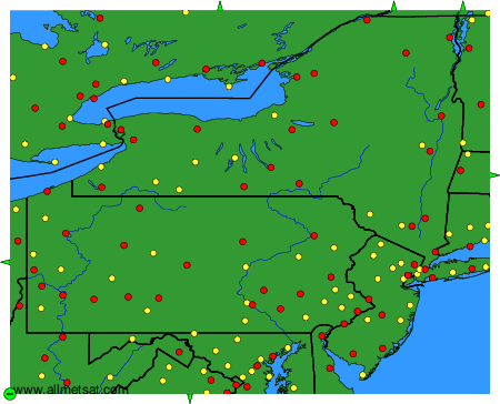
Weather observations and forecasts of more than 4000 airports (METAR and TAF reports).
The available stations are represented by yellow and red dots on the map.
Hover mouse over dot to see the name of the station.
Then click to see weather observations and forecasts.
To change the map : click on the green buttons with a black cross to zoom in, on the green button with a dash to zoom out, or on the green arrows for adjacent maps.