METAR-TAF
Airports :
Arica
Ambato
Andahuaylas
Arequipa
Arica
Atalaya
Ayacucho
Cajamarca
Chiclayo
Cobija
Cochabamba
Cruzeiro do Sul
Cuenca
Cusco
Guayaquil
Ilo
Iquitos
Juanjuí
Juliaca
La Paz
Latacunga
Leticia
Lima
Loja
Macas
Machala
Manta
Nazca
Oruro
Pisco
Pucallpa
Puerto Francisco de Orellana
Puerto Maldonado
Quito
Reyes
Riberalta
Rio Branco
Rurrenabaque
Salinas
San Borja
Santa Ana del Yacuma
São Gabriel da Cachoeira
Shell Mera
Sucre
Tabatinga
Tacna
Talara
Tarapoto
Tarauacá
Tena
Tingo María
Trujillo
Tumbes
Yurimaguas
Peru
Bolivia
Brazil
Chile
Colombia
Ecuador
Galápagos
South America
South Pacific
Chacalluta International Airport Arica, Chile
latitude: 18-20S, longitude: 070-20W, elevation: 58 m
Current weather observation The report was made 40 minutes ago, at 05:00 UTC
Wind 5 kt from the South/Southeast
Temperature 19 °C
Humidity 73 %
Pressure 1014 hPa
Visibility 10 km or more
no clouds below 1500 m and no cumulonimbus
METAR: SCAR 170500Z 16005KT CAVOK 19/14 Q1014
Time: 02:40 (05:40 UTC) Forecast The report was made 1 hour and 30 minutes ago, at 04:10 UTC
Forecast valid from 17 at 06 UTC to 18 at 06 UTC
Wind 4 kt from the South/Southwest
Visibility 10 km or more
Overcast at a height of 2500 ft
Temporary
Visibility: 5000 m
Broken clouds at a height of 800 ft Overcast at a height of 1700 ft
light drizzle
Becoming
Scattered clouds at a height of 3000 ft
Becoming
Visibility 10 km or more
no clouds below 1500 m and no cumulonimbus
Becoming
Wind 14 kt from the South/Southwest
Becoming
Wind 10 kt from the East/Northeast
Becoming
Wind 20 kt from the East/Northeast
TAF: SCAR 170410Z 1706/1806 21004KT 9999 OVC025 TN19/1710Z TX27/1801Z TEMPO 1706/1710 5000 -DZ BKN008 OVC017 BECMG 1710/1712 SCT030 BECMG 1713/1715 CAVOK BECMG 1716/1718 21014KT BECMG 1721/1723 07010KT BECMG 1801/1803 07020KT
Weather observations and forecasts of more than 4000 airports (METAR and TAF reports).
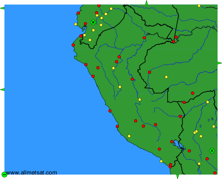
The available stations are represented by yellow and red dots on the map.
Hover mouse over dot to see the name of the station.
Then click to see weather observations and forecasts.
To change the map : click on the green buttons with a black cross to zoom in, on the green button with a dash to zoom out, or on the green arrows for adjacent maps.