METAR-TAF
Airports :
Clark International Airport
Angeles, Philippines
latitude: 15-11N, longitude: 120-33E, elevation: 148 m
Current weather observation
The report was made 36 minutes ago, at 07:00 UTC
Wind 6 kt from the Northeast
Temperature 27°C
Humidity 62%
Pressure 1012 hPa
Visibility: 8000 m
Broken clouds at a height of 2000 ft
Broken clouds at a height of 10000 ft
Broken clouds at a height of 10000 ft
light rain
METAR: RPLC 170700Z 04006KT 8000 -RA BKN020 BKN100 27/19 Q1012 NOSIG RMK A2988
Time: 15:36 (07:36 UTC)
Forecast
The report was made 2 hours and 36 minutes ago, at 05:00 UTC
Forecast valid from 17 at 06 UTC to 18 at 12 UTC
Wind 8 kt from the North/Northwest
Visibility 10 km or more
Few clouds at a height of 2000 ft
Scattered clouds at a height of 10000 ft
Scattered clouds at a height of 10000 ft
Temporary
from 17 at 06 UTC to 17 at 12 UTC
from 17 at 06 UTC to 17 at 12 UTC
Wind 8 kt from the East/Northeast
Visibility: 8000 m
Scattered clouds at a height of 2000 ft
Broken clouds at a height of 10000 ft
Broken clouds at a height of 10000 ft
light rain
TAF: RPLC 170500Z 1706/1812 34008KT 9999 FEW020 SCT100 TX30/1706Z TN20/1721Z TEMPO 1706/1712 07008KT 8000 -RA SCT020 BKN100
Weather observations and forecasts of more than 4000 airports (METAR and TAF reports).
The available stations are represented by yellow and red dots on the map.
Hover mouse over dot to see the name of the station.
Then click to see weather observations and forecasts.
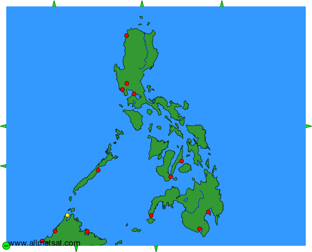
To change the map : click on the green buttons with a black cross to zoom in, on the green button with a dash to zoom out, or on the green arrows for adjacent maps.