METAR-TAF
Airports :
Francisco Bangoy International Airport
Davao, Philippines
latitude: 07-07N, longitude: 125-39E, elevation: 17 m
Current weather observation
Overcast at a height of 8000 ft
METAR: RPMD 311100Z 07002KT 9000 -SHRA FEW015CB OVC080 25/25 Q1010 RMK A2983 CB N-NE,SW
Time: 19:37 (11:37 UTC)
Forecast
Broken clouds at a height of 9000 ft
from 31 at 12 UTC to 31 at 18 UTC
Broken clouds at a height of 9000 ft
from 01 at 00 UTC to 01 at 02 UTC
from 01 at 06 UTC to 01 at 12 UTC
Broken clouds at a height of 9000 ft
TAF: RPMD 311100Z 3112/0112 36004KT 9999 FEW016 BKN090 TEMPO 3112/3118 -TSRA FEW015CB BKN090 BECMG 0100/0102 18008KT TEMPO 0106/0112 -SHRA FEW015CB BKN090
Weather observations and forecasts of more than 4000 airports (METAR and TAF reports).
The available stations are represented by yellow and red dots on the map.
Hover mouse over dot to see the name of the station.
Then click to see weather observations and forecasts.
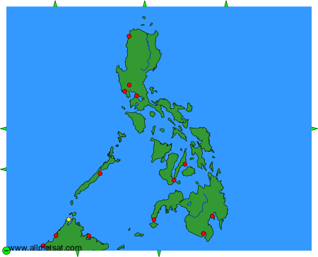
To change the map : click on the green buttons with a black cross to zoom in, on the green button with a dash to zoom out, or on the green arrows for adjacent maps.