METAR-TAF
Airports :
Mactan–Cebu International Airport
Cebu, Philippines
latitude: 10-18-48N, longitude: 123-58-58E, elevation: 23 m
Current weather observation
The report was made 38 minutes ago, at 18:00 UTC
Wind 3 kt from the West, varying between West/Southwest and West/Northwest
Temperature 25°C
Humidity 100%
Pressure 1009 hPa
Visibility: 8000 m
METAR: RPVM 261800Z 27003KT 240V300 8000 NSC 25/25 Q1009 NOSIG RMK A2980
Time: 02:38 (18:38 UTC)
Forecast
The report was made 1 hour and 38 minutes ago, at 17:00 UTC
Forecast valid from 26 at 18 UTC to 27 at 24 UTC
Wind 5 kt from the Southwest
Visibility 10 km or more
Few clouds at a height of 2000 ft
Temporary
from 26 at 18 UTC to 26 at 24 UTC
from 26 at 18 UTC to 26 at 24 UTC
Visibility: 7000 m
Scattered clouds at a height of 1800 ft, Cumulonimbus.
Overcast at a height of 10000 ft
Overcast at a height of 10000 ft
thunderstorm, light rain
Temporary
from 27 at 00 UTC to 27 at 06 UTC
from 27 at 00 UTC to 27 at 06 UTC
Visibility: 8000 m
Few clouds at a height of 1800 ft, Cumulonimbus.
Overcast at a height of 10000 ft
Overcast at a height of 10000 ft
light rain showers
TAF: RPVM 261700Z 2618/2724 22005KT 9999 FEW020 TEMPO 2618/2624 7000 -TSRA SCT018CB OVC100 TEMPO 2700/2706 8000 -SHRA FEW018CB OVC100
Weather observations and forecasts of more than 4000 airports (METAR and TAF reports).
The available stations are represented by yellow and red dots on the map.
Hover mouse over dot to see the name of the station.
Then click to see weather observations and forecasts.
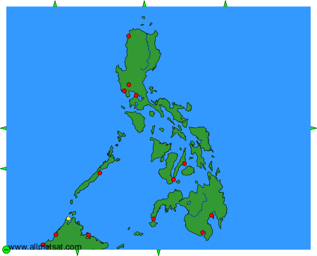
To change the map : click on the green buttons with a black cross to zoom in, on the green button with a dash to zoom out, or on the green arrows for adjacent maps.