METAR-TAF
Airports :
Kaunas
Bratislava
Brest
Brno
Bydgoszcz
Čáslav
Gdańsk
Heringsdorf
Kaliningrad
Katowice
Kaunas
Košice
Kraków
Kristianstad
Linz
Łódź
Lublin
Lviv
Náměšť nad Oslavou
Olsztyn
Ostrava
Palanga
Pardubice
Piešťany
Poprad
Poznań
Prague
Prague
Prague
Radom
Rønne
Rzeszów
Šiauliai
Sliač
Szczecin
Tomaszów Mazowiecki
Tulln an der Donau
Uherské Hradiště
Uzhhorod
Vienna
Warsaw
Warsaw-Modlin
Wrocław
Zielona Góra
Žilina
Poland
Austria
Belarus
Czech Republic
Denmark
Estonia
Europe
Finland
Germany
Hungary
Latvia
Lithuania
Moldova
Norway
Scandinavia, Southwest
Slovakia
Slovenia
Sweden
Ukraine
Kaunas Airport Kaunas, Lithuania
latitude: 54-54N, longitude: 023-55-12E, elevation: 77 m
Current weather observation The report was made 17 minutes ago, at 09:50 UTC
Wind 9 kt from the West
Temperature 9 °C
Humidity 87 %
Pressure 998 hPa
Visibility 10 km or more
Few clouds at a height of 1000 ft Broken clouds at a height of 2300 ft Overcast at a height of 2700 ft
METAR: EYKA 130950Z 28009KT 9999 FEW010 BKN023 OVC027 09/07 Q0998
Time: 13:07 (10:07 UTC) Forecast The report was made 10 hours and 41 minutes ago, at 23:26 UTC
Forecast valid from 13 at 00 UTC to 13 at 24 UTC
Wind 7 kt from the West
Visibility: 5000 m
Overcast at a height of 500 ft
mist
Temporary
Visibility: 3000 m
Overcast at a height of 200 ft
light drizzle
Probability 30% :
Temporary
Visibility: 1500 m
Becoming
Visibility: 9000 m
Overcast at a height of 1000 ft
Becoming
Broken clouds at a height of 2000 ft
Temporary
Wind 15 kt from the West/Southwest with gusts up to 25 kt
Visibility: 5000 m
Scattered clouds at a height of 3000 ft, Cumulonimbus.
rain showers
TAF: EYKA 122326Z 1300/1324 27007KT 5000 BR OVC005 TEMPO 1300/1306 3000 -DZ OVC002 PROB30 TEMPO 1302/1306 1500 BECMG 1306/1308 9000 NSW OVC010 BECMG 1308/1310 BKN020 TEMPO 1314/1319 25015G25KT 5000 SHRA SCT030CB
Weather observations and forecasts of more than 4000 airports (METAR and TAF reports).
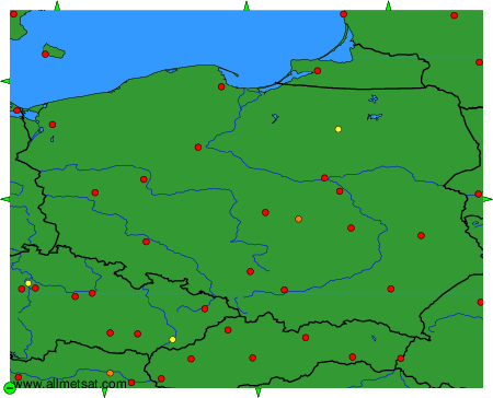
The available stations are represented by yellow and red dots on the map.
Hover mouse over dot to see the name of the station.
Then click to see weather observations and forecasts.
To change the map : click on the green buttons with a black cross to zoom in, on the green button with a dash to zoom out, or on the green arrows for adjacent maps.
