METAR: TFFF 211100Z AUTO 12003KT 080V150 9999 SCT045 BKN060 24/23 Q1013 TEMPO 4000 SHRA BKN020TCU
Time: 07:34 (11:34 UTC)
Forecast
The report was made 34 minutes ago, at 11:00 UTC
Forecast valid from 21 at 12 UTC to 22 at 12 UTC
Wind 2 kt from variable directions
Visibility 10 km or more
Scattered clouds at a height of 2500 ft
Probability 30% :
Temporary from 21 at 12 UTC to 21 at 22 UTC
Wind 15 kt from variable directions
Visibility: 4000 m
Broken clouds at a height of 2000 ft, Towering cumulus.
rain showers
Becoming from 21 at 12 UTC to 21 at 15 UTC
Wind 7 kt from the East
Probability 30% :
Temporary from 21 at 14 UTC to 21 at 20 UTC
Wind 7 kt from the South
Temporary from 22 at 08 UTC to 22 at 11 UTC
Visibility: 4000 m
Scattered clouds at a height of 2000 ft, Towering cumulus.
rain showers
TAF: TFFF 211100Z 2112/2212 VRB02KT 9999 SCT025 PROB30 TEMPO 2112/2122 VRB15KT 4000 SHRA BKN020TCU BECMG 2112/2115 09007KT PROB30 TEMPO 2114/2120 18007KT TEMPO 2208/2211 4000 SHRA SCT020TCU
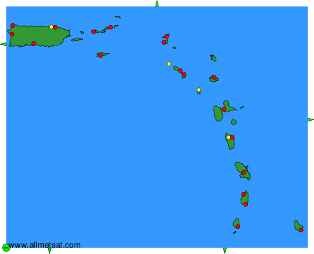
Weather observations and forecasts of more than 4000 airports (METAR and TAF reports).
The available stations are represented by yellow and red dots on the map.
Hover mouse over dot to see the name of the station.
Then click to see weather observations and forecasts.
To change the map : click on the green buttons with a black cross to zoom in, on the green button with a dash to zoom out, or on the green arrows for adjacent maps.