METAR-TAF
Airports :
Aguadilla
Aguadilla
Anguilla
Antigua
Basseterre
Bridgetown
Castries
Fort-de-France
Marigot
Mayagüez
Montserrat
Nevis
Pointe-à-Pitre
Ponce
Roseau
Saint Croix
Saint Thomas
Saint Vincent
San Juan
San Juan-Isla Grande
Sint Eustatius
Sint Maarten
Tortola
Vieux-Fort
Puerto Rico, Lesser Antilles
Bermuda
Cape Verde
Dominican Republic
Haiti
North America
Trinidad and Tobago
Venezuela
Rafael Hernández Airport Aguadilla, Puerto Rico, United States
latitude: 18-30N, longitude: 067-08W, elevation: 72 m
Current weather observation The report was made 3 hours and 38 minutes ago, at 04:50 UTC
Wind 4 kt from the Southeast
Temperature 24 °C
Humidity 100 %
Pressure 1018 hPa
Visibility: 16.1 km
Clear sky
METAR: TJBQ 010450Z 14004KT 10SM CLR 24/24 A3007
Time: 04:28 (08:28 UTC) Forecast The report was made 2 hours and 54 minutes ago, at 05:34 UTC
Forecast valid from 01 at 06 UTC to 02 at 06 UTC
Wind 4 kt from the Southeast
Visibility: 10 km
Few clouds at a height of 3000 ft Scattered clouds at a height of 9000 ft
From 01 at 1400 UTC
Wind 12 kt from the East
Visibility: 10 km
Scattered clouds at a height of 3000 ft
From 01 at 1700 UTC
Wind 16 kt from the East/Northeast with gusts up to 25 kt
Visibility: 10 km
Scattered clouds at a height of 2000 ft, Cumulonimbus. Broken clouds at a height of 3500 ft
thunderstorm in vicinity
Probability 30%
Visibility: 4.8 km
Scattered clouds at a height of 2000 ft, Cumulonimbus. Broken clouds at a height of 3000 ft
thunderstorm, rain
From 01 at 2300 UTC
Wind 10 kt from the East
Visibility: 10 km
Scattered clouds at a height of 3000 ft Broken clouds at a height of 5000 ft
showers in vicinity
TAF: TJBQ 010534Z 0106/0206 14004KT P6SM FEW030 SCT090 FM011400 09012KT P6SM SCT030 FM011700 07016G25KT P6SM VCTS SCT020CB BKN035 PROB30 0117/0121 3SM TSRA SCT020CB BKN030 FM012300 10010KT P6SM VCSH SCT030 BKN050 AMD NOT SKED TIL 011100
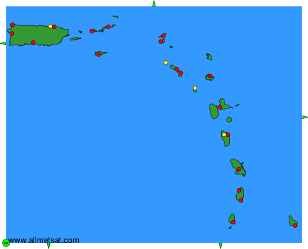
Weather observations and forecasts of more than 4000 airports (METAR and TAF reports).
The available stations are represented by yellow and red dots on the map.
Hover mouse over dot to see the name of the station.
Then click to see weather observations and forecasts.
To change the map : click on the green buttons with a black cross to zoom in, on the green button with a dash to zoom out, or on the green arrows for adjacent maps.