Scattered clouds at a height of 2000 ft Overcast at a height of 6000 ft
Temporary from 13 at 14 UTC to 13 at 16 UTC
Broken clouds at a height of 2000 ft Overcast at a height of 6000 ft
Becoming from 13 at 14 UTC to 13 at 16 UTC
Wind 15 kt from the Southeast with gusts up to 25 kt
From 13 at 1600 UTC
Wind 15 kt from the Southeast with gusts up to 25 kt
Visibility: 9.7 km
Overcast at a height of 2500 ft
light snow
Temporary from 13 at 16 UTC to 13 at 17 UTC
Visibility: 1.2 km
at a height of 800 ft
light snow
From 13 at 1700 UTC
Wind 15 kt from the Southeast with gusts up to 25 kt
Visibility: 0.8 km
at a height of 600 ft
snow
Temporary from 13 at 17 UTC to 13 at 24 UTC
Visibility: 3.2 km
Overcast at a height of 1500 ft
light snow
From 14 at 0000 UTC
Wind 12 kt from the Southeast with gusts up to 22 kt
Visibility: 1.2 km
at a height of 800 ft
light snow
Temporary from 14 at 00 UTC to 14 at 02 UTC
Visibility: 4.8 km
Overcast at a height of 1500 ft
light snow
TAF: CYQA 131340Z 1314/1402 13008KT P6SM SCT020 OVC060 TEMPO 1314/1316 BKN020 OVC060 BECMG 1314/1316 13015G25KT FM131600 13015G25KT 6SM -SN OVC025 TEMPO 1316/1317 3/4SM -SN VV008 FM131700 13015G25KT 1/2SM SN VV006 TEMPO 1317/1324 2SM -SN OVC015 FM140000 13012G22KT 3/4SM -SN VV008 TEMPO 1400/1402 3SM -SN OVC015 RMK FCST BASED ON AUTO OBS. NXT FCST BY 132000Z
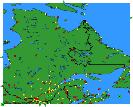
Weather observations and forecasts of more than 4000 airports (METAR and TAF reports).
The available stations are represented by yellow and red dots on the map.
Hover mouse over dot to see the name of the station.
Then click to see weather observations and forecasts.
To change the map : click on the green buttons with a black cross to zoom in, on the green button with a dash to zoom out, or on the green arrows for adjacent maps.