METAR-TAF
Airports :
Pristina
Arad
Bacau
Baia Mare
Bălţi
Batajnica
Békéscsaba
Belgrade
Bucharest
Bucharest Băneasa
Burgas
Câmpia Turzii
Chernivtsi
Chisinau
Cluj-Napoca
Constanţa
Çorlu
Craiova
Debrecen
Florești
Iasi
Istanbul
Ivano-Frankivsk
Košice
Kraljevo
Niš
Ohrid
Oradea
Plovdiv
Pristina
Satu Mare
Sibiu
Skopje
Sofia
Suceava
Szeged
Szolnok
Târgu Mureş
Timişoara
Tulcea
Uzhhorod
Varna
Veliko Tarnovo
Vršac
Romania, Bulgaria
Albania
Belarus
Bosnia and Herzegovina
Croatia
Europe
Greece
Hungary
Macedonia
Moldova
Montenegro
Serbia
Slovakia
Turkey
Ukraine
Pristina International Airport Pristina, Kosovo
latitude: 42-34-27N, longitude: 21-02-09E, elevation: 545 m
Current weather observation The report was made 6 minutes ago, at 04:00 UTC
Wind 3 kt from the North/Northwest , varying between West/Northwest and North
Temperature 14 °C
Humidity 100 %
Pressure 1020 hPa
Visibility: 1500 m
Few clouds at a height of 500 ft
mist
METAR: BKPR 210400Z 34003KT 290V010 1500 BR FEW005 14/14 Q1020 TEMPO 0800 BCFG
Time: 06:06 (04:06 UTC) Forecast The report was made 4 hours and 36 minutes ago, at 23:30 UTC
Forecast valid from 21 at 00 UTC to 21 at 24 UTC
Wind 6 kt from the North
Visibility 10 km or more
Few clouds at a height of 8000 ft
Temporary from 21 at 02 UTC to 21 at 07 UTC
Visibility: 3000 m
mist
Probability 30% from 21 at 03 UTC to 21 at 05 UTC
Visibility: 0600 m
Scattered clouds at a height of 500 ft
patches of fog
Temporary from 20 at 12 UTC to 20 at 21 UTC
Wind 15 kt from variable directions with gusts up to 25 kt
Visibility: 4000 m
Scattered clouds at a height of 3000 ft, Cumulonimbus. Broken clouds at a height of 4000 ft
thunderstorm, rain
TAF: BKPR 202330Z 2100/2124 35006KT 9999 FEW080 TEMPO 2102/2107 3000 BR PROB30 2103/2105 0600 BCFG SCT005 TEMPO 2012/2021 VRB15G25KT 4000 TSRA SCT030CB BKN040
Weather observations and forecasts of more than 4000 airports (METAR and TAF reports).
The available stations are represented by yellow and red dots on the map.
Hover mouse over dot to see the name of the station.
Then click to see weather observations and forecasts.
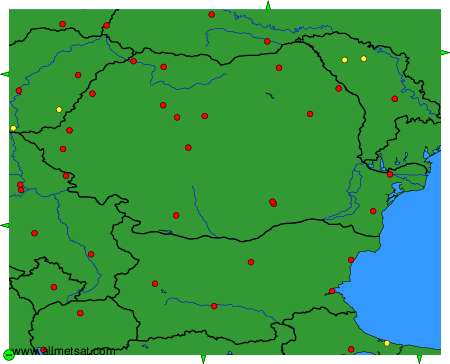
To change the map : click on the green buttons with a black cross to zoom in, on the green button with a dash to zoom out, or on the green arrows for adjacent maps.