METAR-TAF
Airports :
Saskatoon
Assiniboia
Bow Island
Brandon
Bratt's Lake No. 129
Broadview
Brooks
Buffalo Narrows
Buffalo Narrows
Carman
Cold Lake
Coronach
Coronation
Cut Bank
Cypress Hills
Dauphin
Deerwood RCS
Devils Lake
Drumheller
Eastend Cypress
Estevan
Esther
Flin Flon
Fort Chipewyan
Fort McMurray
Glasgow
Grand Rapids
Havre
Jimmy Lake
Key Lake
Kindersley
Lac La Biche
La Ronge
Leader
Lethbridge
Lloydminster
Lucky Lake
Lynn Lake
Maple Creek
Meadow Lake
Medicine Hat
Melfort
Milk River
Minot
Minot
Moose Jaw
Morden
Nipawin
North Battleford
Onefour
Pilot Mound
Portage la Prairie
Prince Albert
Regina
Regina
Rockglen
Rosetown
Rugby
Saskatoon
Southend
Spiritwood
Stony Rapids
Suffield
Swan River
Swift Current
Tadoule Lake
The Pas
Uranium City
Val Marie
Vegreville
Watrous
Weyburn
Williston
Wolf Point
Wynyard
Yorkton
Saskatchewan
Alberta
Dakota
Manitoba
Montana, East
Montana, West
North America
Northwest Territories
Nunavut
Yukon
Saskatoon John G. Diefenbaker International Airport Saskatoon, Saskatchewan, Canada
latitude: 52-10N, longitude: 106-41W, elevation: 501 m
Current weather observation The report was made 45 minutes ago, at 07:00 UTC
Wind 7 kt from the South
Temperature 11 °C
Humidity 43 %
Pressure 1015 hPa
Visibility: 24.1 km
Few clouds at a height of 100 ft
METAR: CYXE 130700Z 19007KT 15SM FEW001 11/M01 A2996 RMK SF1 SF TR SLP156
Time: 01:45 (07:45 UTC) Forecast The report was made 2 hours and 5 minutes ago, at 05:40 UTC
Forecast valid from 13 at 06 UTC to 14 at 06 UTC
Wind 3 kt from variable directions
Visibility: 10 km
Few clouds at a height of 9000 ft Scattered clouds at a height of 25000 ft
Becoming
Wind 10 kt from the South/Southeast
From 13 at 1800 UTC
Wind 20 kt from the South/Southeast with gusts up to 30 kt
Visibility: 10 km
Few clouds at a height of 25000 ft
From 14 at 0000 UTC
Wind 18 kt from the Southeast with gusts up to 28 kt
Visibility: 10 km
Broken clouds at a height of 14000 ft
TAF: CYXE 130540Z 1306/1406 VRB03KT P6SM FEW090 SCT250 BECMG 1306/1308 16010KT FM131800 16020G30KT P6SM FEW250 FM140000 14018G28KT P6SM BKN140 RMK NXT FCST BY 131200Z
Weather observations and forecasts of more than 4000 airports (METAR and TAF reports).
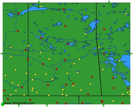
The available stations are represented by yellow and red dots on the map.
Hover mouse over dot to see the name of the station.
Then click to see weather observations and forecasts.
To change the map : click on the green buttons with a black cross to zoom in, on the green button with a dash to zoom out, or on the green arrows for adjacent maps.
