METAR-TAF
Airports :
Tel Aviv / Ben Gurion
Abadan
Abadeh
Abha
Abu Dhabi
Abu Dhabi Bateen
Abu Musa
Aghajari
Ahvaz
Al Ain
Al Bahah
Al Ghaydah
Al-Hasa
Ali Al Salem
Al Khardj
Al Udeid
Al-`Ula
Al Wajh
Amman
Amman-Queen Alia
Aqaba
Arar
Asaluyeh
Baghdad
Bahrain
Balad
Bandar Abbas
Bandar Kangan
Bandar Lengeh
Basra
Beirut
Bisha
Buraidah
Bushehr
Damascus
Dammam
Dawadmi
Dhahran
Doha
Doha
Dubai
Dubai
Eilat
Esfahān
Fasa
Fujairah
Gachsaran
Hafar Al-Batin
Haifa
Ha'il
Hajjah
Ilam
Jask
Jeddah
Jizan
Jubail
Kashan
Kerman
Khamis Mushait
Kharg Island
Khorramabad
Kish
Kuwait City
Lamerd
Lar
Lavan Island
Mahshahr
Marsa Alam
Masjed Soleyman
Mecca
Medina
Najaf
Najran
Port Sudan
Qaisumah
Qeshm
Qurayyat
Rafha
Ras al-Khaimah
Riyadh
Riyadh
Rosh Pinna
Saint Catherine
Sakakah
Salalah
Sana'a
Seiyun
Shahrekord
Sharjah
Sharm el-Sheikh
Sharurah
Shiraz
Sirri
Taba
Tabas
Tabuk
Ta’if
Tel Aviv
Turaif
Wadi ad-Dawasir
Yanbu
Yasuj
Yazd
Saudi Arabia
Africa
Bahrain
Central African Republic
Chad
Djibouti
Egypt
Eritrea
Ethiopia
Indian Ocean islands
Iran
Iraq
Israel
Jordan
Kuwait
Lebanon
Oman
Palestine
Qatar
Sudan
Syria
United Arab Emirates
Yemen
Ben Gurion Airport Tel Aviv / Ben Gurion, Israel
latitude: 32-00N, longitude: 034-54E, elevation: 40 m
Current weather observation The report was made 7 minutes ago, at 04:20 UTC
Wind 12 kt from the Southeast
Temperature 24 °C
Humidity 54 %
Pressure 1006 hPa
Visibility 10 km or more
Few clouds at a height of 4500 ft
METAR: LLBG 020420Z 14012KT 9999 FEW045 24/14 Q1006 NOSIG RMK BKN120
Time: 07:27 (04:27 UTC) Forecast The report was made 5 hours and 25 minutes ago, at 23:02 UTC
Forecast valid from 02 at 00 UTC to 02 at 24 UTC
Wind 7 kt from the East
Visibility 10 km or more
no clouds below 1500 m and no cumulonimbus
Probability 40% :
Temporary
Wind 15 kt from the South with gusts up to 25 kt
Visibility: 5000 m
Few clouds at a height of 5000 ft, Cumulonimbus. Broken clouds at a height of 9000 ft
thunderstorm, rain
Becoming
Wind 12 kt from the West/Southwest
Visibility 10 km or more
Scattered clouds at a height of 4500 ft
Probability 30% :
Temporary
Broken clouds at a height of 3000 ft
light rain
Becoming
Wind 5 kt from the West
Scattered clouds at a height of 3500 ft
TAF: LLBG 012302Z 0200/0224 09007KT CAVOK TX24/0209Z TN18/0202Z PROB40 TEMPO 0200/0204 18015G25KT 5000 TSRA FEW050CB BKN090 BECMG 0204/0206 24012KT 9999 SCT045 PROB30 TEMPO 0206/0212 -RA BKN030 BECMG 0212/0214 28005KT SCT035
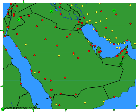
Weather observations and forecasts of more than 4000 airports (METAR and TAF reports).
The available stations are represented by yellow and red dots on the map.
Hover mouse over dot to see the name of the station.
Then click to see weather observations and forecasts.
To change the map : click on the green buttons with a black cross to zoom in, on the green button with a dash to zoom out, or on the green arrows for adjacent maps.
