METAR-TAF
Airports :
George Best Belfast City Airport
Belfast City, Northern Ireland
latitude: 54-36N, longitude: 005-53W, elevation: 5 m
Current weather observation
The report was made 29 minutes ago, at 06:20 UTC
Wind 5 kt from the West/Southwest, varying between Southwest and West/Northwest
Temperature 16°C
Humidity 72%
Pressure 1020 hPa
Visibility 10 km or more
Overcast at a height of 2000 ft
METAR: EGAC 240620Z AUTO 25005KT 220V290 9999 OVC020 16/11 Q1020
Time: 07:49 (06:49 UTC)
Forecast
The report was made 1 hour and 53 minutes ago, at 04:56 UTC
Forecast valid from 24 at 06 UTC to 24 at 15 UTC
Wind 9 kt from the West/Southwest
Visibility 10 km or more
Broken clouds at a height of 2500 ft
Probability 40% :
Temporary
from 24 at 06 UTC to 24 at 09 UTC
from 24 at 06 UTC to 24 at 09 UTC
Broken clouds at a height of 1200 ft
TAF: EGAC 240456Z 2406/2415 24009KT 9999 BKN025 PROB40 TEMPO 2406/2409 BKN012
Weather observations and forecasts of more than 4000 airports (METAR and TAF reports).
The available stations are represented by yellow and red dots on the map.
Hover mouse over dot to see the name of the station.
Then click to see weather observations and forecasts.
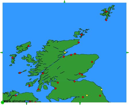
To change the map : click on the green buttons with a black cross to zoom in, on the green button with a dash to zoom out, or on the green arrows for adjacent maps.