METAR-TAF
Airports :
City of Derry Airport
Derry, Northern Ireland
latitude: 55-03N, longitude: 007-09W, elevation: 9 m
Current weather observation
The report was made 6 hours and 28 minutes ago, at 20:20 UTC
Wind 10 kt from the West/Southwest
Temperature 17°C
Humidity 94%
Pressure 1011 hPa
Visibility 10 km or more
Few clouds at a height of 900 ft
Broken clouds at a height of 1200 ft
Broken clouds at a height of 1200 ft
METAR: EGAE 282020Z 24010KT 9999 FEW009 BKN012 17/16 Q1011
Time: 03:48 (02:48 UTC)
Forecast
The report was made 9 hours and 45 minutes ago, at 17:03 UTC
Forecast valid from 28 at 18 UTC to 28 at 22 UTC
Wind 9 kt from the West/Southwest
Visibility 10 km or more
Scattered clouds at a height of 1500 ft
Temporary
from 28 at 18 UTC to 28 at 22 UTC
from 28 at 18 UTC to 28 at 22 UTC
Visibility: 6000 m
Broken clouds at a height of 900 ft
rain, rain showers
TAF: EGAE 281703Z 2818/2822 24009KT 9999 SCT015 TEMPO 2818/2822 6000 RA SHRA BKN009
Weather observations and forecasts of more than 4000 airports (METAR and TAF reports).
The available stations are represented by yellow and red dots on the map.
Hover mouse over dot to see the name of the station.
Then click to see weather observations and forecasts.
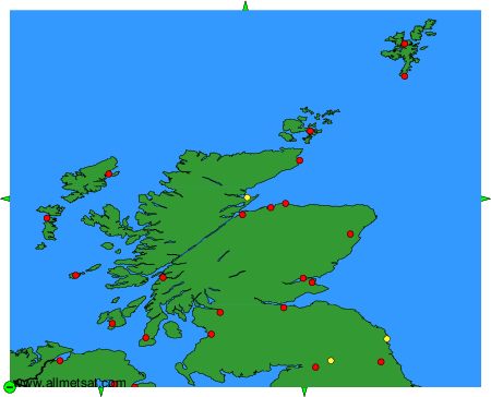
To change the map : click on the green buttons with a black cross to zoom in, on the green button with a dash to zoom out, or on the green arrows for adjacent maps.