METAR-TAF
Airports :
Kirkwall Airport
Kirkwall, Scotland
latitude: 58-57N, longitude: 002-54W, elevation: 21 m
Current weather observation
METAR: EGPA 072350Z AUTO 26012KT 8000 OVC002/// 14/13 Q1013
Time: 01:04 (00:04 UTC)
Forecast
Broken clouds at a height of 600 ft
from 08 at 00 UTC to 08 at 03 UTC
from 08 at 00 UTC to 08 at 06 UTC
from 08 at 00 UTC to 08 at 04 UTC
from 08 at 03 UTC to 08 at 06 UTC
from 08 at 06 UTC to 08 at 09 UTC
TAF: EGPA 072257Z 0800/0809 20008KT 9999 SCT002 BKN006 BECMG 0800/0803 26012KT TEMPO 0800/0806 3000 -DZRA BR BKN002 PROB30 TEMPO 0800/0804 1200 BKN001 BECMG 0803/0806 BKN008 PROB30 TEMPO 0806/0809 4000 -DZRA BKN004
Weather observations and forecasts of more than 4000 airports (METAR and TAF reports).
The available stations are represented by yellow and red dots on the map.
Hover mouse over dot to see the name of the station.
Then click to see weather observations and forecasts.
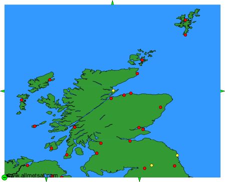
To change the map : click on the green buttons with a black cross to zoom in, on the green button with a dash to zoom out, or on the green arrows for adjacent maps.