METAR-TAF
Airports :
Seletar Airport
Singapore, Singapore
latitude: 01-25-08N, longitude: 103-51-57E, elevation: 11 m
Current weather observation
The report was made 58 minutes ago, at 13:00 UTC
Wind 9 kt from the North/Northeast
Temperature 27°C
Humidity 84%
Pressure 1011 hPa
Visibility 10 km or more
Few clouds at a height of 1600 ft
Scattered clouds at a height of 16000 ft
Broken clouds at a height of 30000 ft
Scattered clouds at a height of 16000 ft
Broken clouds at a height of 30000 ft
METAR: WSSL 151300Z 02009KT 9999 FEW016 SCT160 BKN300 27/24 Q1011
Time: 21:58 (13:58 UTC)
Forecast
The report was made 2 hours and 58 minutes ago, at 11:00 UTC
Forecast valid from 15 at 12 UTC to 16 at 18 UTC
Wind 8 kt from the North
Visibility 10 km or more
Few clouds at a height of 1500 ft
Scattered clouds at a height of 2000 ft
Scattered clouds at a height of 2000 ft
TAF: WSSL 151100Z 1512/1618 35008KT 9999 FEW015 SCT020
Weather observations and forecasts of more than 4000 airports (METAR and TAF reports).
The available stations are represented by yellow and red dots on the map.
Hover mouse over dot to see the name of the station.
Then click to see weather observations and forecasts.
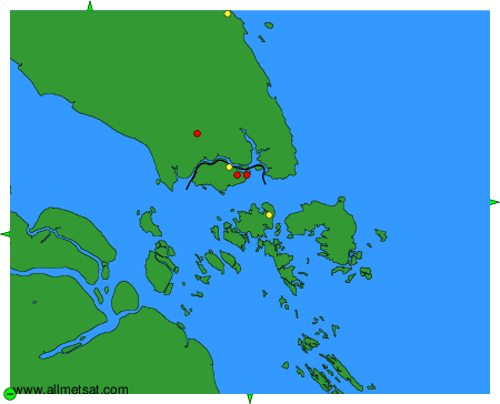
To change the map : click on the green buttons with a black cross to zoom in, on the green button with a dash to zoom out, or on the green arrows for adjacent maps.