METAR-TAF
Airports :
Osijek
Arad
Banja Luka
Bari
Batajnica
Békéscsaba
Belgrade
Brač
Brindisi
Capri
Castrignano del Capo
Cerklje ob Krki
Corfu
Crotone
Dubrovnik
Foggia
Foggia
Gioia del Colle
Graz
Grazzanise
Hévíz
Ioannina
Kecskemét
Klagenfurt
Kozani
Kraljevo
Larissa
Lecce
Ljubljana
Maribor
Monte Scuro
Mostar
Naples
Niš
Ohrid
Osijek
Pécs
Pescara
Podgorica
Portorož
Pristina
Pula
Rijeka
Salerno
Sarajevo
Skiathos
Skopje
Sofia
Split
Szeged
Taranto
Tarvisio
Thessaloniki
Timişoara
Tirana
Tivat
Trevico
Trieste
Tuzla
Užice
Volos
Vršac
Zadar
Zagreb
Croatia, Bosnia and Herzegovina, Serbia, Montenegro, Albania, Macedonia
Austria
Bulgaria
Czech Republic
Europe
Greece
Hungary
Italy
Romania
Slovakia
Slovenia
Osijek Airport Osijek, Croatia
latitude: 45-27N, longitude: 018-48E, elevation: 88 m
Current weather observation The report was made 12 minutes ago, at 02:00 UTC
Wind 3 kt from the West/Southwest , varying between South/Southwest and West/Northwest
Temperature 13 °C
Humidity 88 %
Pressure 1003 hPa
Visibility 10 km or more
no clouds below 1500 m and no cumulonimbus
METAR: LDOS 120200Z COR 25003KT 200V300 CAVOK 13/11 Q1003
Time: 04:12 (02:12 UTC) Forecast The report was made 2 hours and 47 minutes ago, at 23:25 UTC
Forecast valid from 12 at 00 UTC to 12 at 24 UTC
Wind 8 kt from the West/Southwest
Visibility 10 km or more
Broken clouds at a height of 4000 ft
Probability 40% :
Temporary
Wind 15 kt from the West with gusts up to 25 kt
Few clouds at a height of 2500 ft, Cumulonimbus. Broken clouds at a height of 3000 ft
thunderstorm, rain
Becoming
Wind 10 kt from the North/Northeast
Becoming
Wind 25 kt from the North/Northwest with gusts up to 40 kt
Probability 40% :
Temporary
Visibility: 4000 m
Scattered clouds at a height of 2500 ft, Cumulonimbus. Broken clouds at a height of 3000 ft
thunderstorm, rain
Becoming
Wind 18 kt from the Northwest with gusts up to 28 kt
Becoming
Wind 10 kt from the West/Northwest
TAF: LDOS 112325Z 1200/1224 25008KT 9999 BKN040 TX18/1211Z TN05/1223Z PROB40 TEMPO 1200/1213 27015G25KT TSRA FEW025CB BKN030 BECMG 1209/1211 02010KT BECMG 1213/1215 34025G40KT PROB40 TEMPO 1213/1216 4000 TSRA SCT025CB BKN030 BECMG 1216/1218 31018G28KT BECMG 1218/1220 29010KT
Weather observations and forecasts of more than 4000 airports (METAR and TAF reports).
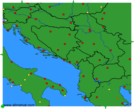
The available stations are represented by yellow and red dots on the map.
Hover mouse over dot to see the name of the station.
Then click to see weather observations and forecasts.
To change the map : click on the green buttons with a black cross to zoom in, on the green button with a dash to zoom out, or on the green arrows for adjacent maps.
