METAR: FABL 290000Z AUTO 00000KT 9999 ///////// 16/16 Q1020
Time: 02:21 (00:21 UTC)
Forecast
The report was made 2 hours and 21 minutes ago, at 22:00 UTC
Forecast valid from 29 at 00 UTC to 29 at 24 UTC
Wind 3 kt from variable directions
Visibility 10 km or more
Few clouds at a height of 4000 ft Broken clouds at a height of 10000 ft
Probability 30% :
Temporary from 29 at 00 UTC to 29 at 06 UTC
Few clouds at a height of 4000 ft, Cumulonimbus.
thunderstorm, light rain
Probability 30% :
Temporary from 29 at 03 UTC to 29 at 06 UTC
Visibility: 5000 m
Overcast at a height of 1000 ft
mist
Probability 30% :
Temporary from 29 at 18 UTC to 29 at 22 UTC
Broken clouds at a height of 2000 ft Few clouds at a height of 3000 ft, Cumulonimbus.
thunderstorm, light rain
TAF: FABL 282200Z 2900/2924 VRB03KT 9999 FEW040 BKN100 TX26/2912Z TN15/2903Z PROB30 TEMPO 2900/2906 -TSRA FEW040CB PROB30 TEMPO 2903/2906 5000 BR OVC010 PROB30 TEMPO 2918/2922 -TSRA BKN020 FEW030CB
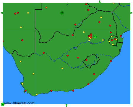
Weather observations and forecasts of more than 4000 airports (METAR and TAF reports).
The available stations are represented by yellow and red dots on the map.
Hover mouse over dot to see the name of the station.
Then click to see weather observations and forecasts.
To change the map : click on the green buttons with a black cross to zoom in, on the green button with a dash to zoom out, or on the green arrows for adjacent maps.