METAR-TAF
Airports :
King Shaka International Airport
Durban, South Africa
latitude: 29-36-52S, longitude: 031-06-59E, elevation: 90 m
Current weather observation
The report was made 1 hour and 10 minutes ago, at 22:00 UTC
Wind 2 kt from the South
Temperature 19°C
Humidity 94%
Pressure 1014 hPa
Visibility: 7000 m
Overcast at a height of 900 ft
METAR: FALE 052200Z 19002KT 7000 OVC009 19/18 Q1014 NOSIG
Time: 01:10 (23:10 UTC)
Forecast
The report was made 7 hours and 10 minutes ago, at 16:00 UTC
Forecast valid from 05 at 18 UTC to 06 at 24 UTC
Wind 3 kt from variable directions
Visibility 10 km or more
Scattered clouds at a height of 1000 ft
Broken clouds at a height of 1500 ft
Broken clouds at a height of 1500 ft
Probability 30% :
Temporary
from 05 at 22 UTC to 06 at 03 UTC
from 05 at 22 UTC to 06 at 03 UTC
Visibility: 0500 m
Broken clouds at a height of 500 ft
fog
From 06 at 0800 UTC
Wind 8 kt from the East
Visibility 10 km or more
no clouds below 1500 m and no cumulonimbus
Becoming
from 06 at 18 UTC to 06 at 20 UTC
from 06 at 18 UTC to 06 at 20 UTC
Wind 3 kt from variable directions
TAF: FALE 051600Z 0518/0624 VRB03KT 9999 SCT010 BKN015 TX29/0612Z TN18/0603Z PROB30 TEMPO 0522/0603 0500 FG BKN005 FM060800 08008KT CAVOK BECMG 0618/0620 VRB03KT
Weather observations and forecasts of more than 4000 airports (METAR and TAF reports).
The available stations are represented by yellow and red dots on the map.
Hover mouse over dot to see the name of the station.
Then click to see weather observations and forecasts.
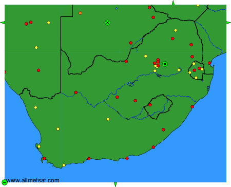
To change the map : click on the green buttons with a black cross to zoom in, on the green button with a dash to zoom out, or on the green arrows for adjacent maps.