METAR-TAF
Airports :
Saga Airport
Saga, Japan
latitude: 33-09N, longitude: 130-18E, elevation: 7 ft
Current weather observation
Scattered clouds at a height of 6000 ft
Broken clouds at a height of 12000 ft
METAR: RJFS 221000Z 05007KT 9999 -RA FEW020 SCT060 BKN120 22/20 Q1008
Time: 19:13 (10:13 UTC)
Forecast
Scattered clouds at a height of 4500 ft
Broken clouds at a height of 5000 ft
from 22 at 12 UTC to 22 at 15 UTC
from 22 at 18 UTC to 23 at 00 UTC
from 23 at 00 UTC to 23 at 06 UTC
Broken clouds at a height of 1000 ft
from 23 at 06 UTC to 23 at 09 UTC
TAF: RJFS 220505Z 2206/2312 03010KT 9000 -RA FEW010 SCT045 BKN050 TEMPO 2212/2215 4000 SHRA BR TEMPO 2218/2300 4000 SHRA BR TEMPO 2300/2306 3000 SHRA BR BKN005 BKN010 TEMPO 2306/2309 4000 SHRA BR BKN008
Weather observations and forecasts of more than 4000 airports (METAR and TAF reports).
The available stations are represented by yellow and red dots on the map.
Hover mouse over dot to see the name of the station.
Then click to see weather observations and forecasts.
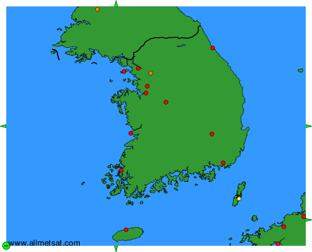
To change the map : click on the green buttons with a black cross to zoom in, on the green button with a dash to zoom out, or on the green arrows for adjacent maps.