METAR-TAF
Airports :
Seoul Air Base
Seoul-Seongnam, South Korea
latitude: 37-26N, longitude: 127-07E, elevation: 20 m
Current weather observation
The report was made 46 minutes ago, at 06:00 UTC
Wind 6 kt from the South
Temperature 26°C
Humidity 100%
Pressure 1006 hPa
Visibility: 8000 m
Few clouds at a height of 1000 ft
Broken clouds at a height of 1500 ft
Overcast at a height of 3000 ft
Broken clouds at a height of 1500 ft
Overcast at a height of 3000 ft
light rain, mist
METAR: RKSM 210600Z 18006KT 8000 -RA BR FEW010 BKN015 OVC030 26/26 A2971
Time: 15:46 (06:46 UTC)
Forecast
The report was made 1 hour and 46 minutes ago, at 05:00 UTC
Forecast valid from 21 at 06 UTC to 22 at 12 UTC
Wind 6 kt from the South/Southwest
Visibility: 4800 m
Broken clouds at a height of 3000 ft
light rain, mist
TAF: RKSM 210500Z 2106/2212 21006KT 4800 -RA BR BKN030 TN25/2121Z TX29/2206Z
Weather observations and forecasts of more than 4000 airports (METAR and TAF reports).
The available stations are represented by yellow and red dots on the map.
Hover mouse over dot to see the name of the station.
Then click to see weather observations and forecasts.
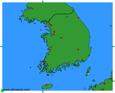
To change the map : click on the green buttons with a black cross to zoom in, on the green button with a dash to zoom out, or on the green arrows for adjacent maps.