METAR-TAF
Airports :
Wadesboro
Abingdon
Ahoskie
Aiken
Albemarle
Anderson
Asheboro
Asheville
Athens
Augusta
Augusta
Beaufort
Beaufort
Beckley
Bennettsville
Blacksburg
Blackstone
Bluefield
Boone
Bristol / Johnson / Kingsport
Burlington
Camp Mackall
Chapel Hill
Charleston
Charleston
Charlotte
Cheraw
Cherry Point
Chesapeake
Clemson
Clinton
Columbia-Metropolitan
Columbia-Owens
Concord
Conway
Danville
Darlington
Dublin
Dublin
Eastman
Eastover
Edenton
Elizabeth City
Elizabethtown
Emporia
Erwin
Farmville
Fayetteville
Fayetteville / Pope
Florence
Fort Bragg
Fort Eustis
Franklin
Galax / Hillsville
Gastonia
Georgetown
Goldsboro
Goldsboro / Seymour Johnson
Greensboro
Greenville
Greenville
Greenville
Greenwood
Greer
Hatteras
Hickory
Hilton Head Island
Hinesville
Hot Springs
Jackson
Jacksonville-Albert J. Ellis
Jacksonville-MCAS New River
Kenansville
Kill Devil Hills
Kingstree
Kinston
Lancaster
Langley
Lewisburg
Lexington
Lincolnton
Louisburg
Lumberton
Lynchburg
Manning
Manteo
Marion
Marion / Wytheville
Martinsville
Maxton
Melfa
Milledgeville
Monroe
Morganton
Morristown
Mount Airy
Myrtle Beach
New Bern
Newberry
Newport News
Norfolk
Norfolk
Norfolk
North Myrtle Beach
North Wilkesboro
Orangeburg
Oxford
Petersburg
Pickens
Pikeville
Pinehurst / Southern Pines
Pineville
Piney Island
Raleigh / Durham
Richmond
Richmond
Richmond / Ashland
Roanoke
Rock Hill
Rocky Mount
Roxboro
Rutherfordton
Salisbury
Sanford
Savannah
Savannah
Shelby
Siler City
Smithfield
South Hill
Southport
Spartanburg
Statesboro
Statesville
Suffolk
Summerville
Sumter
Sumter
Swansboro
Sylvania
Tangier
Thomson
Vidalia
Virginia Beach
Wadesboro
Wakefield
Wallops Island
Washington
West Jefferson
West Point
Whiteville
Williamsburg
Wilmington
Winnsboro
Winston Salem
Wise
North Carolina, South Carolina
Bermuda
Delaware
Georgia
Kentucky
Maryland
North America
Tennessee
Virginia
Anson County Airport Wadesboro, North Carolina, United States
latitude: 35-01-14N, longitude: 080-04-38W, elevation: 298 ft
Current weather observation The report was made 18 minutes ago, at 05:15 UTC
Wind 3 mph from the North
Temperature 45 °F
Humidity 81 %
Pressure 30.48 in. Hg
Visibility: 10 miles
Overcast at a height of 1900 ft
METAR: KAFP 030515Z AUTO 36003KT 10SM OVC019 07/04 A3048 RMK AO2 T00700035
Time: 00:33 (05:33 UTC) TAF: missing
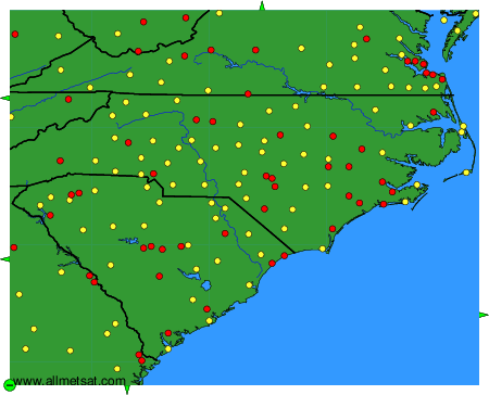
Weather observations and forecasts of more than 4000 airports (METAR and TAF reports).
The available stations are represented by yellow and red dots on the map.
Hover mouse over dot to see the name of the station.
Then click to see weather observations and forecasts.
To change the map : click on the green buttons with a black cross to zoom in, on the green button with a dash to zoom out, or on the green arrows for adjacent maps.