Main page
METAR-TAF:

METAR-TAF

Airports :

Rocky Mount–Wilson Regional Airport

Rocky Mount, North Carolina, United States

latitude: 35-51-18N, longitude: 077-53-35W, elevation: 49 m

Current weather observation

The report was made 57 minutes ago, at 07:53 UTC
Wind 9 kt from the North
Temperature 18°C
Humidity 77%
Pressure 1019 hPa
Visibility: 16.1 km
Few clouds at a height of 1800 ft
Broken clouds at a height of 6500 ft
Broken clouds at a height of 11000 ft

METAR: KRWI 160753Z AUTO 01009KT 10SM FEW018 BKN065 BKN110 18/14 A3008 RMK AO2 RAB25E40 SLP186 P0000 T01830144

Time: 04:50 (08:50 UTC)

Forecast

The report was made 3 hours and 10 minutes ago, at 05:40 UTC
Forecast valid from 16 at 06 UTC to 17 at 06 UTC
Wind 11 kt from the North
Visibility: 10 km
Scattered clouds at a height of 2000 ft
Broken clouds at a height of 6000 ft
Overcast at a height of 9000 ft
From 16 at 0700 UTC
Wind 11 kt from the North
Visibility: 10 km
Broken clouds at a height of 2000 ft
Overcast at a height of 6000 ft
From 16 at 0900 UTC
Wind 12 kt from the North
Visibility: 9.7 km
Broken clouds at a height of 1500 ft
Overcast at a height of 6000 ft
light rain
From 16 at 1200 UTC
Wind 12 kt from the North/Northwest with gusts up to 20 kt
Visibility: 6.4 km
Overcast at a height of 800 ft
rain, mist,

TAF: KRWI 160540Z 1606/1706 36011KT P6SM SCT020 BKN060 OVC090 FM160700 36011KT P6SM BKN020 OVC060 FM160900 35012KT 6SM -RA BKN015 OVC060 FM161200 34012G20KT 4SM RA BR OVC008

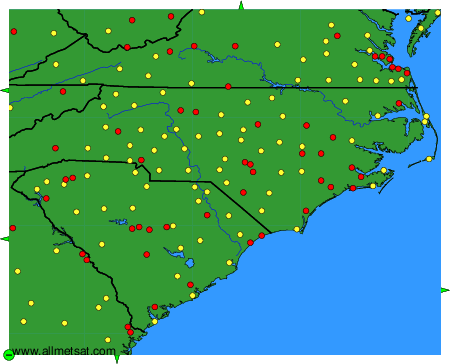
Weather observations and forecasts of more than 4000 airports (METAR and TAF reports).

The available stations are represented by yellow and red dots on the map.

Hover mouse over dot to see the name of the station.

Then click to see weather observations and forecasts.

To change the map : click on the green buttons with a black cross to zoom in, on the green button with a dash to zoom out, or on the green arrows for adjacent maps.


METAR-TAF: