METAR-TAF
Airports :
Avalon
Adelaide
Albury
Avalon
Broken Hill
Canberra
Cooma
Dubbo
Griffith
Hobart
Launceston
Melbourne
Merimbula
Mildura
Mount Gambier
Mudgee
Narrandera
Newcastle
Nowra
Richmond
Sydney
Wagga Wagga
Wangaratta
Australia, Southeast
Antarctica
Australia
New Zealand
Avalon Airport Avalon, Australia
latitude: 38-02S, longitude: 144-29E, elevation: 8 m
Current weather observation The report was made 20 minutes ago, at 23:00 UTC
Wind 16 kt from the West
Temperature 14 °C
Humidity 82 %
Pressure 1022 hPa
Visibility 10 km or more
Few clouds at a height of 4700 ft
METAR: YMAV 072300Z AUTO 27016KT 9999 // FEW047 14/11 Q1022
Time: 09:20 (23:20 UTC) Forecast The report was made 6 hours and 6 minutes ago, at 17:14 UTC
Forecast valid from 07 at 18 UTC to 08 at 18 UTC
Wind 14 kt from the West
Visibility 10 km or more
Broken clouds at a height of 1500 ft
light drizzle
From 07 at 2300 UTC
Wind 15 kt from the Southwest with gusts up to 25 kt
Visibility 10 km or more
Scattered clouds at a height of 2000 ft Broken clouds at a height of 3500 ft
light rain showers
From 08 at 0400 UTC
Wind 14 kt from the Southwest
Visibility 10 km or more
Scattered clouds at a height of 2000 ft Broken clouds at a height of 3500 ft
light rain showers
From 08 at 1000 UTC
Wind 10 kt from the West/Southwest
Visibility 10 km or more
Scattered clouds at a height of 1400 ft Broken clouds at a height of 2500 ft
light rain showers
Temporary from 07 at 18 UTC to 07 at 23 UTC
Wind 18 kt from the West with gusts up to 28 kt
Visibility: 4000 m
Broken clouds at a height of 1200 ft
drizzle
Temporary from 08 at 12 UTC to 08 at 18 UTC
Visibility: 5000 m
Broken clouds at a height of 1200 ft
rain showers
TAF: YMAV 071714Z 0718/0818 27014KT 9999 -DZ BKN015 FM072300 23015G25KT 9999 -SHRA SCT020 BKN035 FM080400 23014KT 9999 -SHRA SCT020 BKN035 FM081000 25010KT 9999 -SHRA SCT014 BKN025 TEMPO 0718/0723 27018G28KT 4000 DZ BKN012 TEMPO 0812/0818 5000 SHRA BKN012
Weather observations and forecasts of more than 4000 airports (METAR and TAF reports).
The available stations are represented by yellow and red dots on the map.
Hover mouse over dot to see the name of the station.
Then click to see weather observations and forecasts.
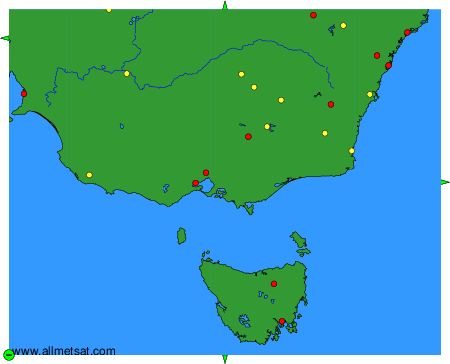
To change the map : click on the green buttons with a black cross to zoom in, on the green button with a dash to zoom out, or on the green arrows for adjacent maps.