METAR-TAF
Airports :
Edwards
Avalon
Bakersfield
Barstow
Bishop
Bridgeport
Burbank
Camarillo
Campo
Carlsbad
China Lake Acres
Chino
Concord
Corona
Edwards
El Centro
El Monte
Fairfield
Fort Irwin National Training Center
Fresno
Fresno
Fullerton
Half Moon Bay
Hanford
Hawthorne
Hayward
Henderson
Hollister
Imperial
Imperial Beach
Indian Springs
Lancaster
Las Vegas
La Verne
Lemoore
Livermore
Lompoc
Long Beach
Los Alamitos
Los Angeles
Los Angeles
Los Angeles
Madera
Mammoth Lakes
Marin County
Merced
Merced
Mercury
Mexicali
Modesto
Mojave
Monterey
Mountain View
Mount Wilson Observatory
Napa
Nellis
North Las Vegas
Oakland
Oceanside
Oceanside / Camp Pendleton
Ontario
Oxnard
Palmdale
Palm Springs
Palo Alto
Paso Robles
Point Mugu
Porterville
Ramona
Riverside
Riverside
Salinas
San Bernardino
San Carlos
San Clemente
Sandberg
San Diego
San Diego
San Diego
San Diego / El Cajon
San Diego / Miramar
San Diego / North Island
San Francisco
San Jose
San Jose
San Luis Obispo
San Nicolas Island
Santa Ana
Santa Barbara
Santa Maria
Santa Monica
Santa Rosa
Santa Ynez
Stockton
Tehachapi
Thermal
Tijuana
Tonopah
Torrance
Twentynine Palms
Vacaville
Vandenberg
Van Nuys
Victorville
Visalia
Watsonville
California, South
Arizona
California, Los Angeles, San Diego
California, North
Mexico, Northwest
Nevada
North America
Edwards Air Force Base Edwards, California, United States
latitude: 34-55N, longitude: 117-54W, elevation: 2303 ft
Current weather observation The report was made 54 minutes ago, at 19:55 UTC
Wind 16 mph from the West/Southwest
Temperature 79 °F
Humidity 24 %
Pressure 30.05 in. Hg
Visibility: 90 miles
Scattered clouds at a height of 40000 ft
METAR: KEDW 241955Z 24014KT 90SM SCT400 26/04 A3005 RMK AO2A SLP164 T02560035
Time: 12:49 (20:49 UTC) Forecast The report was made 6 hours and 49 minutes ago, at 14:00 UTC
Forecast valid from 24 at 14 UTC to 25 at 20 UTC
Wind 6 mph from variable directions
Visibility 6.2 miles or more
Few clouds at a height of 15000 ft Broken clouds at a height of 27000 ft
Becoming
Wind 12 mph from the West/Southwest
Visibility 6.2 miles or more
Few clouds at a height of 15000 ft Broken clouds at a height of 27000 ft
Becoming
Wind 12 mph from the West with gusts up to 23 mph
Visibility 6.2 miles or more
Few clouds at a height of 15000 ft Broken clouds at a height of 27000 ft
Becoming
Wind 12 mph from the West/Southwest with gusts up to 17 mph
Visibility 6.2 miles or more
Few clouds at a height of 15000 ft Broken clouds at a height of 27000 ft
Becoming
Wind 12 mph from the West/Southwest
Visibility 6.2 miles or more
Broken clouds at a height of 30000 ft
Becoming
Wind 12 mph from the West with gusts up to 17 mph
Visibility 6.2 miles or more
Broken clouds at a height of 30000 ft
TAF: KEDW 241400Z 2414/2520 VRB05KT 9999 FEW150 BKN270 QNH3011INS BECMG 2417/2418 24010KT 9999 FEW150 BKN270 QNH3008INS BECMG 2419/2420 26010G20KT 9999 FEW150 BKN270 QNH3004INS BECMG 2503/2504 25010G15KT 9999 FEW150 BKN270 QNH3008INS BECMG 2511/2512 24010KT 9999 BKN300 QNH3008INS BECMG 2517/2518 27010G15KT 9999 BKN300 QNH3009INS TX26/2422Z TN14/2514Z
Weather observations and forecasts of more than 4000 airports (METAR and TAF reports).
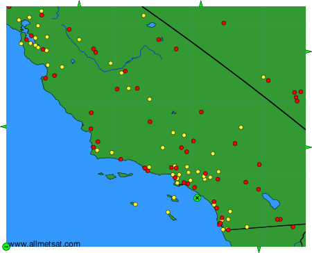
The available stations are represented by yellow and red dots on the map.
Hover mouse over dot to see the name of the station.
Then click to see weather observations and forecasts.
To change the map : click on the green buttons with a black cross to zoom in, on the green button with a dash to zoom out, or on the green arrows for adjacent maps.
