METAR-TAF
Airports :
Imperial Beach
Avalon
Bakersfield
Barstow
Bishop
Bridgeport
Burbank
Camarillo
Campo
Carlsbad
China Lake Acres
Chino
Concord
Corona
Edwards
El Centro
El Monte
Fairfield
Fort Irwin National Training Center
Fresno
Fresno
Fullerton
Half Moon Bay
Hanford
Hawthorne
Hayward
Henderson
Hollister
Imperial
Imperial Beach
Indian Springs
Lancaster
Las Vegas
La Verne
Lemoore
Livermore
Lompoc
Long Beach
Los Alamitos
Los Angeles
Los Angeles
Los Angeles
Madera
Mammoth Lakes
Marin County
Merced
Merced
Mercury
Mexicali
Modesto
Mojave
Monterey
Mountain View
Mount Wilson Observatory
Napa
Nellis
North Las Vegas
Oakland
Oceanside
Oceanside / Camp Pendleton
Ontario
Oxnard
Palmdale
Palm Springs
Palo Alto
Paso Robles
Point Mugu
Porterville
Ramona
Riverside
Riverside
Salinas
San Bernardino
San Carlos
San Clemente
Sandberg
San Diego
San Diego
San Diego
San Diego / El Cajon
San Diego / Miramar
San Diego / North Island
San Francisco
San Jose
San Jose
San Luis Obispo
San Nicolas Island
Santa Ana
Santa Barbara
Santa Maria
Santa Monica
Santa Rosa
Santa Ynez
Stockton
Tehachapi
Thermal
Tijuana
Tonopah
Torrance
Twentynine Palms
Vacaville
Vandenberg
Van Nuys
Victorville
Visalia
Watsonville
California, South
Arizona
California, Los Angeles, San Diego
California, North
Mexico, Northwest
Nevada
North America
Naval Outlying Landing Field Imperial Beach Imperial Beach, California, United States
latitude: 32-33-47N, longitude: 117-06-36W, elevation: 23 ft
Current weather observation The report was made 1 hour and 3 minutes ago, at 15:53 UTC
Wind 8 mph from the East
Temperature 63 °F
Humidity 88 %
Pressure 29.96 in. Hg
Clear sky
METAR: KNRS 241553Z AUTO 09007KT CLR 17/15 A2996 RMK AO2 SLP143 T01720150 PWINO $
Time: 09:56 (16:56 UTC) TAF: missing
Weather observations and forecasts of more than 4000 airports (METAR and TAF reports).
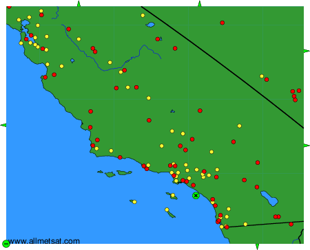
To change the map : click on the green buttons with a black cross to zoom in, on the green button with a dash to zoom out, or on the green arrows for adjacent maps.