METAR: CYLD 220100Z 11003KT 060V130 15SM FEW007 SCT059 SCT085CB 14/13 A2994 RMK CF1SC3CB1 CF TR LAST STFD OBS/NEXT 221000 UTC SLP148 DENSITY ALT 1700FT
Time: 04:47 (08:47 UTC)
Forecast
The report was made 13 hours and 2 minutes ago, at 19:45 UTC
Forecast valid from 21 at 20 UTC to 22 at 01 UTC
Wind 8 kt from the East/Northeast
Visibility: 10 km
Scattered clouds at a height of 6000 ft Broken clouds at a height of 8000 ft
Temporary from 21 at 20 UTC to 21 at 22 UTC
Wind 15 kt from variable directions with gusts up to 25 kt
Visibility: 3.2 km
Broken clouds at a height of 6000 ft, Cumulonimbus.
thunderstorm, heavy rain, mist
From 21 at 2200 UTC
Wind 5 kt from the South/Southeast
Visibility: 10 km
Broken clouds at a height of 8000 ft
Temporary from 21 at 22 UTC to 21 at 24 UTC
Visibility: 10 km
light rain showers
TAF: CYLD 211945Z 2120/2201 07008KT P6SM SCT060 BKN080 TEMPO 2120/2122 VRB15G25KT 2SM +TSRA BR BKN060CB FM212200 16005KT P6SM BKN080 TEMPO 2122/2124 P6SM -SHRA RMK NXT FCST BY 221200Z
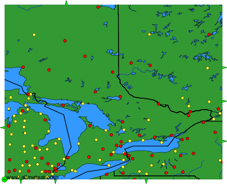
Weather observations and forecasts of more than 4000 airports (METAR and TAF reports).
The available stations are represented by yellow and red dots on the map.
Hover mouse over dot to see the name of the station.
Then click to see weather observations and forecasts.
To change the map : click on the green buttons with a black cross to zoom in, on the green button with a dash to zoom out, or on the green arrows for adjacent maps.