Main page
METAR-TAF:

METAR-TAF

Airports :

Windsor International Airport

Windsor, Ontario, Canada

latitude: 42-16N, longitude: 082-58W, elevation: 623 ft

Current weather observation

The report was made 38 minutes ago, at 23:00 UTC
Wind 24 mph from the Southwest with gusts up to 35 mph
Temperature 70°F
Humidity 49%
Pressure 29.65 in. Hg
Visibility: 9 miles
Clear sky

METAR: CYQG 162300Z AUTO 22021G30KT 9SM CLR 21/10 A2965 RMK SLP041 DENSITY ALT 1800FT

Time: 19:38 (23:38 UTC)

Forecast

The report was made 5 hours and 58 minutes ago, at 17:40 UTC
Forecast valid from 16 at 18 UTC to 17 at 18 UTC
Wind 15 mph from the South/Southwest with gusts up to 26 mph
Visibility: 6 miles
Scattered clouds at a height of 8000 ft
Broken clouds at a height of 12000 ft
Temporary
from 16 at 18 UTC to 16 at 21 UTC
Visibility: 6 miles
Broken clouds at a height of 8000 ft
Overcast at a height of 12000 ft
light rain showers
From 16 at 2100 UTC
Wind 12 mph from the South/Southwest with gusts up to 23 mph
Visibility: 6 miles
Scattered clouds at a height of 7000 ft
Broken clouds at a height of 16000 ft
Temporary
from 16 at 21 UTC to 16 at 23 UTC
Visibility: 6 miles
Broken clouds at a height of 7000 ft
Overcast at a height of 14000 ft
light rain showers
Probability 30%
from 16 at 21 UTC to 16 at 23 UTC
Wind 21 mph from variable directions with gusts up to 40 mph
Visibility: 2 miles
Broken clouds at a height of 2000 ft, Cumulonimbus.
Overcast at a height of 6000 ft
thunderstorm, (heavy) hail, rain, mist
From 17 at 0100 UTC
Wind 12 mph from the South
Visibility: 6 miles
Broken clouds at a height of 4000 ft
Overcast at a height of 12000 ft
light rain showers
Probability 40%
from 17 at 01 UTC to 17 at 03 UTC
Wind 23 mph from variable directions with gusts up to 46 mph
Visibility: 1 miles
Scattered clouds at a height of 800 ft
Broken clouds at a height of 2000 ft, Cumulonimbus.
Overcast at a height of 4000 ft
thunderstorm, (heavy) hail, rain, mist
From 17 at 0300 UTC
Wind 8 mph from the South
Visibility: 6 miles
Broken clouds at a height of 4000 ft
Broken clouds at a height of 16000 ft
From 17 at 0600 UTC
Wind 8 mph from the Southwest
Visibility: 6 miles
Few clouds at a height of 900 ft
Broken clouds at a height of 2500 ft
From 17 at 1200 UTC
Wind 9 mph from the West/Southwest
Visibility: 6 miles
Scattered clouds at a height of 2500 ft
Broken clouds at a height of 18000 ft
Becoming
from 17 at 14 UTC to 17 at 16 UTC
Wind 9 mph from the West/Southwest with gusts up to 21 mph
Broken clouds at a height of 3000 ft
Broken clouds at a height of 12000 ft

TAF: CYQG 161740Z 1618/1718 21013G23KT P6SM SCT080 BKN120 TEMPO 1618/1621 P6SM -SHRA BKN080 OVC120 FM162100 20010G20KT P6SM SCT070 BKN160 TEMPO 1621/1623 P6SM -SHRA BKN070 OVC140 PROB30 1621/1623 VRB18G35KT 2SM +TSGRRA BR BKN020CB OVC060 FM170100 19010KT P6SM -SHRA BKN040 OVC120 PROB40 1701/1703 VRB20G40KT 1SM +TSGRRA BR SCT008 BKN020CB OVC040 FM170300 19007KT P6SM BKN040 BKN160 FM170600 22007KT P6SM FEW009 BKN025 FM171200 24008KT P6SM SCT025 BKN180 BECMG 1714/1716 24008G18KT BKN030 BKN120 RMK FCST BASED ON AUTO OBS. NXT FCST BY 170000Z

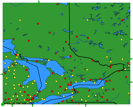
Weather observations and forecasts of more than 4000 airports (METAR and TAF reports).

The available stations are represented by yellow and red dots on the map.

Hover mouse over dot to see the name of the station.

Then click to see weather observations and forecasts.

To change the map : click on the green buttons with a black cross to zoom in, on the green button with a dash to zoom out, or on the green arrows for adjacent maps.


METAR-TAF: