METAR-TAF
Airports :
Bangor
Auburn / Lewiston
Augusta
Bagotville
Baie-Comeau
Bangor
Bar Harbor
Barre / Montpelier
Beauceville
Beauport
Berlin
Burlington
Cap Tourmente
Caribou
Chamouchouane
Charlevoix
Clayton Lake
Concord
Deschambault-Grondines
Franklin County
Frelighsburg
Frenchville
Fryeburg
Gatineau
Glens Falls
Greenville
High Falls
Houlton
Ile-aux-Grues
Ile Bicquette
Île d'Orléans
Ile Rouge
Jonquière
Keene
La Baie
L Acadie
Lac-Jacques-Cartier
Laconia
La Pocatière
L'Assomption
La Tuque
Lebanon
Lennoxville
Lyndonville
Manchester
Massena
Millinocket
Mistook
Mont-Joli
Montreal
Montreal-Mirabel
Montreal Trudeau
Mont-Tremblant
Morrisville
Mount Washington
Newport
Nicolet
Normandin
Onatchiway
Ottawa
Parent
Plattsburgh
Plymouth
Pointe Claveau
Portland
Portsmouth
Presque Isle
Quebec City
Rivière-du-Loup
Roberval
Rochester
Rockland
Rome
Rutland
Saint-Anicet
Sainte-Anne-de-Bellevue
Sainte-Clotilde-de-Châteauguay
Sainte-Foy
Saint-Hubert
Saint-Léonard
Sanford
Saranac Lake
Sherbrooke
Springfield
St. Johnsbury
Trois-Rivières
Trois-Rivières
Valcartier
Varennes
Waterville
Whitefield
Wiscasset
Quebec, South
Maritimes
New England
New York
North America
Ontario, South
Pennsylvania
Quebec
Bangor International Airport Bangor, Maine, United States
latitude: 44-47-50N, longitude: 068-49-07W, elevation: 58 m
Current weather observation The report was made 51 minutes ago, at 12:53 UTC
Wind 4 kt from the West/Southwest
Temperature -1 °C
Humidity 86 %
Pressure 1015 hPa
Visibility: 16.1 km
Scattered clouds at a height of 1800 ft Scattered clouds at a height of 6000 ft
METAR: KBGR 261253Z 24004KT 10SM SCT018 SCT060 M01/M03 A2998 RMK AO2 SLP155 T10111028
Time: 08:44 (13:44 UTC) Forecast The report was made 2 hours and 24 minutes ago, at 11:20 UTC
Forecast valid from 26 at 12 UTC to 27 at 12 UTC
Wind kt from the North
Visibility: 10 km
Scattered clouds at a height of 2500 ft
From 26 at 1600 UTC
Wind 5 kt from the South/Southeast
Visibility: 10 km
Scattered clouds at a height of 2500 ft
From 26 at 1900 UTC
Wind 6 kt from the South/Southeast
Visibility: 8.0 km
Overcast at a height of 1800 ft
light rain
From 26 at 2100 UTC
Wind 5 kt from the East/Southeast
Visibility: 3.2 km
Overcast at a height of 700 ft
light rain
From 27 at 0100 UTC
Wind 3 kt from variable directions
Visibility: 3.2 km
Overcast at a height of 400 ft
light rain, mist
From 27 at 0500 UTC
Wind 3 kt from variable directions
Visibility: 4.8 km
Overcast at a height of 600 ft
mist
From 27 at 0800 UTC
Wind 3 kt from variable directions
Visibility: 10 km
Broken clouds at a height of 3000 ft
TAF: KBGR 261120Z 2612/2712 00000KT P6SM SCT025 FM261600 16005KT P6SM SCT025 FM261900 15006KT 5SM -RA OVC018 FM262100 12005KT 2SM -RA OVC007 FM270100 VRB03KT 2SM -RA BR OVC004 FM270500 VRB03KT 3SM BR OVC006 FM270800 VRB03KT P6SM BKN030
Weather observations and forecasts of more than 4000 airports (METAR and TAF reports).
The available stations are represented by yellow and red dots on the map.
Hover mouse over dot to see the name of the station.
Then click to see weather observations and forecasts.
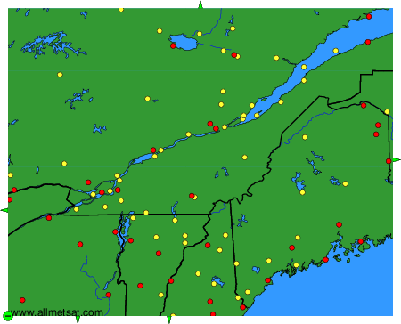
To change the map : click on the green buttons with a black cross to zoom in, on the green button with a dash to zoom out, or on the green arrows for adjacent maps.